Map of Doral, Florida
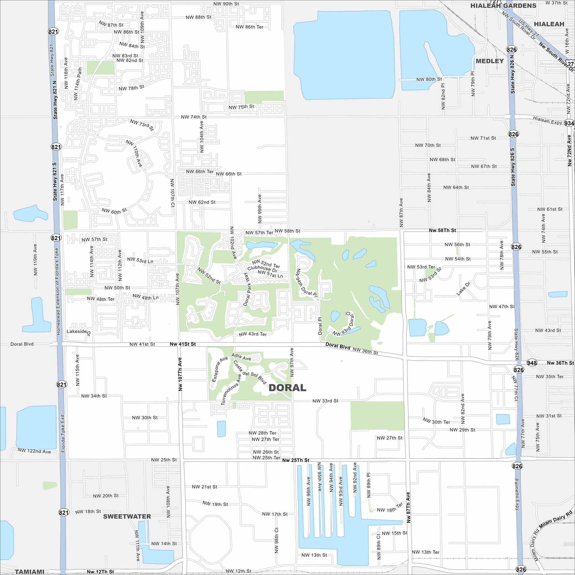
Take a look at our map of Doral in Miami-Dade County. Wide boulevards, lakes, and green golf courses fill the layout. It’s known as a business hub right next to Miami International Airport.
Florida State Maps
Discover Florida through our state maps


Map Information
On the Map
Interstates/Highways: State Rte 821, State Rte 826, State Rte 948, Palmetto Expy Major Roads: Doral Blvd, NW 87th Ave, NW 107th Ave, NW 41st St, NW 36th St, NW 25th St, NW 74th St, NW 58th St, NW 12th St, NW 97th Ave, NW 79th Ave, NW 114th Ave, NW 82nd Ave, Milam Dairy Rd, NW 102nd Ave, NW 54th St, NW 52nd St, NW 33rd St, NW 17th St Nearby Communities: Hialeah Gardens, Hialeah, Medley, Sweetwater, TamiamiFlorida City Maps
Chart your course through Miami and Florida’s cities


