Map of Dunedin, Florida
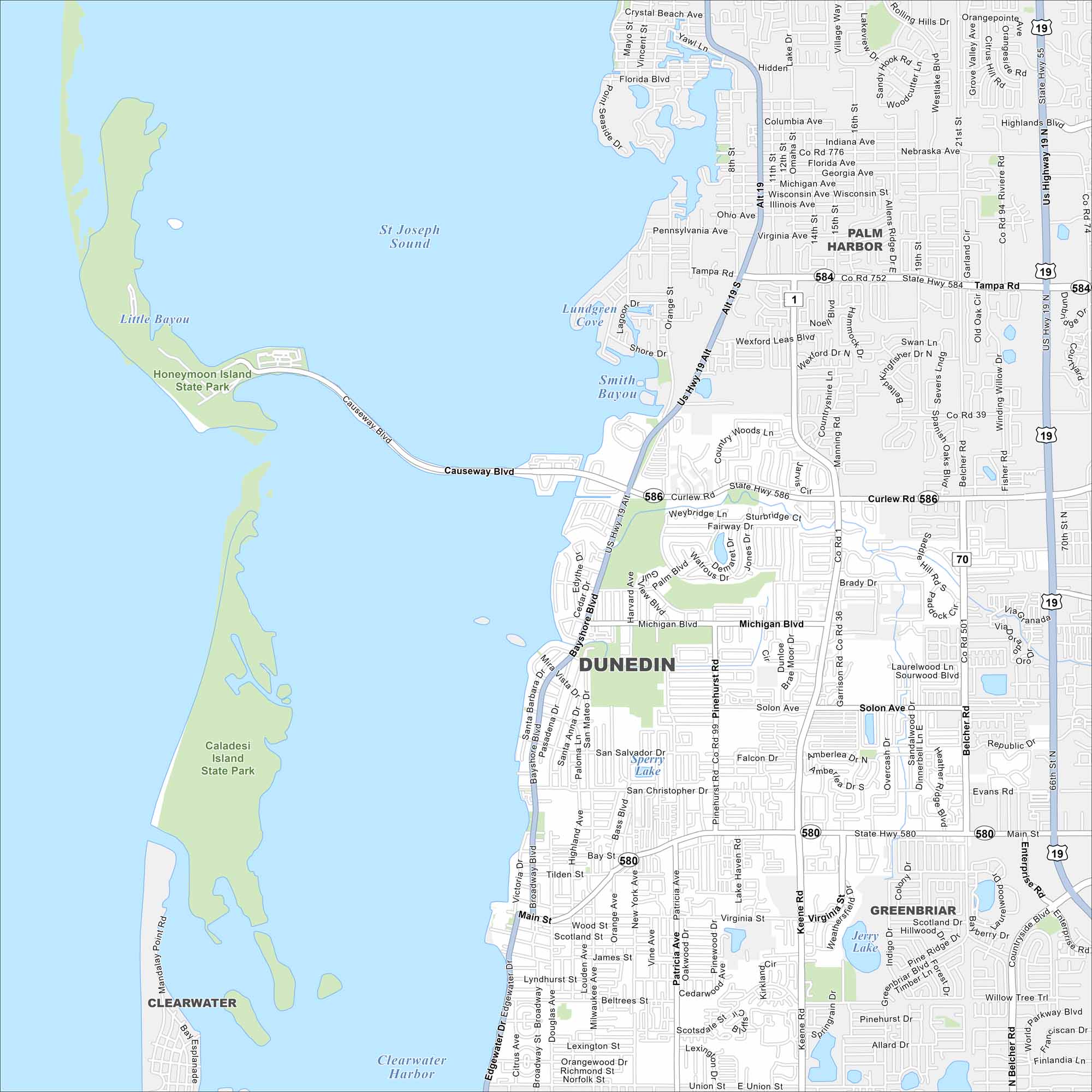
Explore our map of Dunedin along Florida’s Gulf Coast. You’ll spot sandy beaches, offshore islands, and green coastal parks. The city is known for its easy access to Honeymoon Island and Caladesi Island.
Florida State Maps
Discover Florida through our state maps


Map Information
On the Map
Interstates/Highways: US Hwy 19, State Rte 580, State Rte 584, State Rte 586 Major Roads: Main St, Curlew Rd, Bayshore Blvd, Causeway Blvd, Keene Rd, Belcher Rd, Skinner Blvd, Virginia St, Solon Ave, Michigan Blvd, Pinehurst Rd, San Salvador Dr, Beltrees St, Douglas Ave, Milwaukee Ave, Lake Haven Rd, Garrison Rd, Brady Dr, County Rd 1, County Rd 39 Airports: Lakes and Reservoirs: St Joseph Sound, Clearwater Harbor, Sperry Lake, Jerry Lake, Smith Bayou, Lundgren Cove Parks and Preserves: Honeymoon Island State Park, Caladesi Island State Park Nearby Communities: Palm Harbor, Greenbriar, ClearwaterFlorida City Maps
Chart your course through Miami and Florida’s cities


