Map of West Palm Beach, Florida
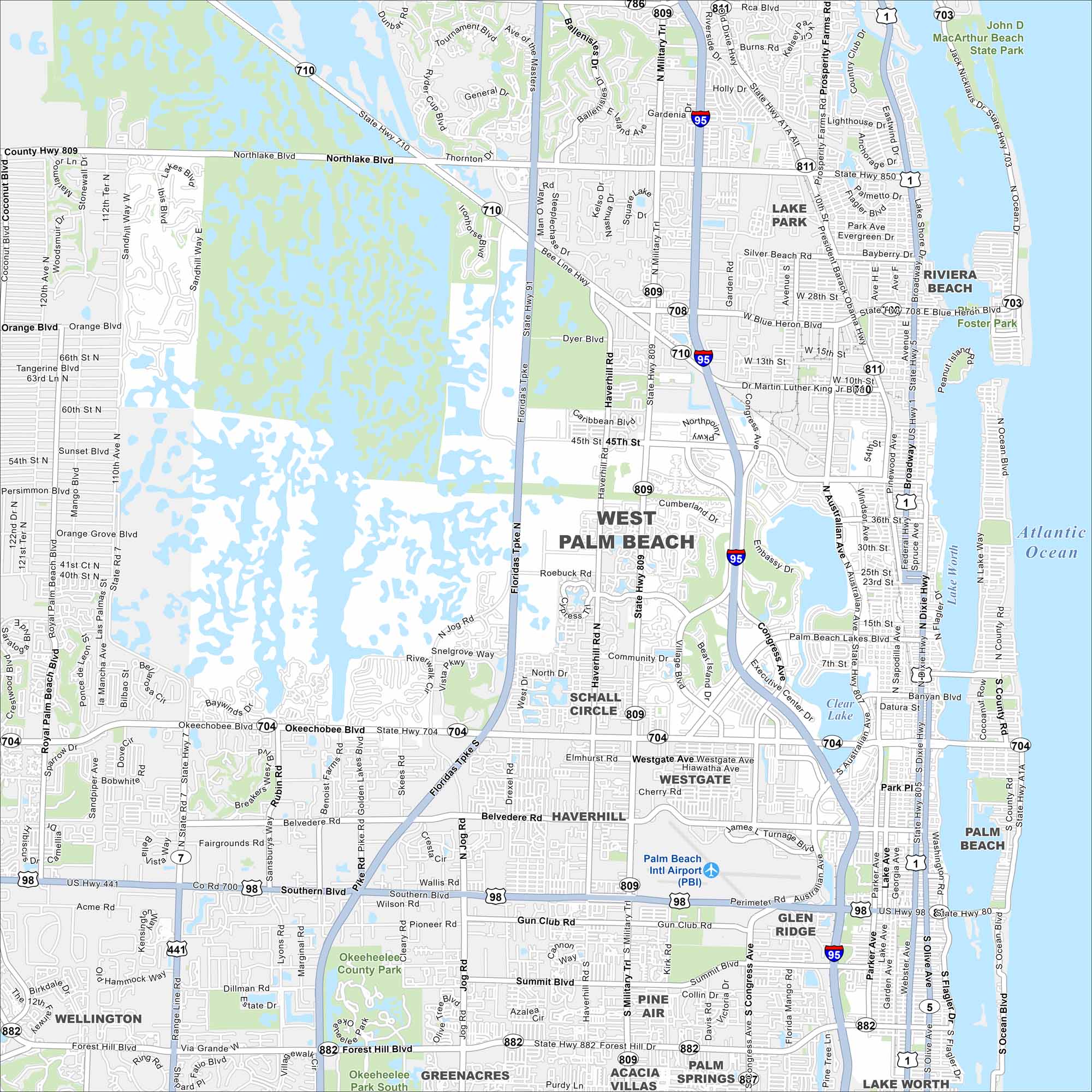
Our West Palm Beach map highlights the downtown waterfront. Palm-lined streets and the Intracoastal Waterway set the scene. Plus, it’s not too far from the Atlantic Ocean on the east side.
Florida State Maps
Discover Florida through our state maps


Map Information
On the Map
Interstates/Highways: I-95, US Hwy 1, US Hwy 98, State Hwy 710, State Hwy 704, State Hwy 80, State Hwy 809, State Hwy 807, State Hwy 7, State Hwy 850, State Hwy 811 Major Roads: Okeechobee Blvd, Southern Blvd, Belvedere Rd, Forest Hill Blvd, Military Trl, Congress Ave, Northlake Blvd, Blue Heron Blvd, Australian Ave, Dixie Hwy, Flagler Dr, Palm Beach Lakes Blvd, Gun Club Rd, Summit Blvd, Purdy Ln, Jog Rd, Haverhill Rd, Roebuck Rd, 45th St, Village Blvd Airports: Palm Beach Intl Airport (PBI) Lakes and Reservoirs: Atlantic Ocean, Lake Worth, Clear Lake Parks and Preserves: John D MacArthur Beach State Park, Okeeheelee County Park Nearby Communities: Lake Park, Riviera Beach, Palm Beach, Haverhill, Glen Ridge, Cloud Lake, Palm Springs, Greenacres, Wellington, Schall CircleFlorida City Maps
Chart your course through Miami and Florida’s cities


