Map of East Lansing, Michigan
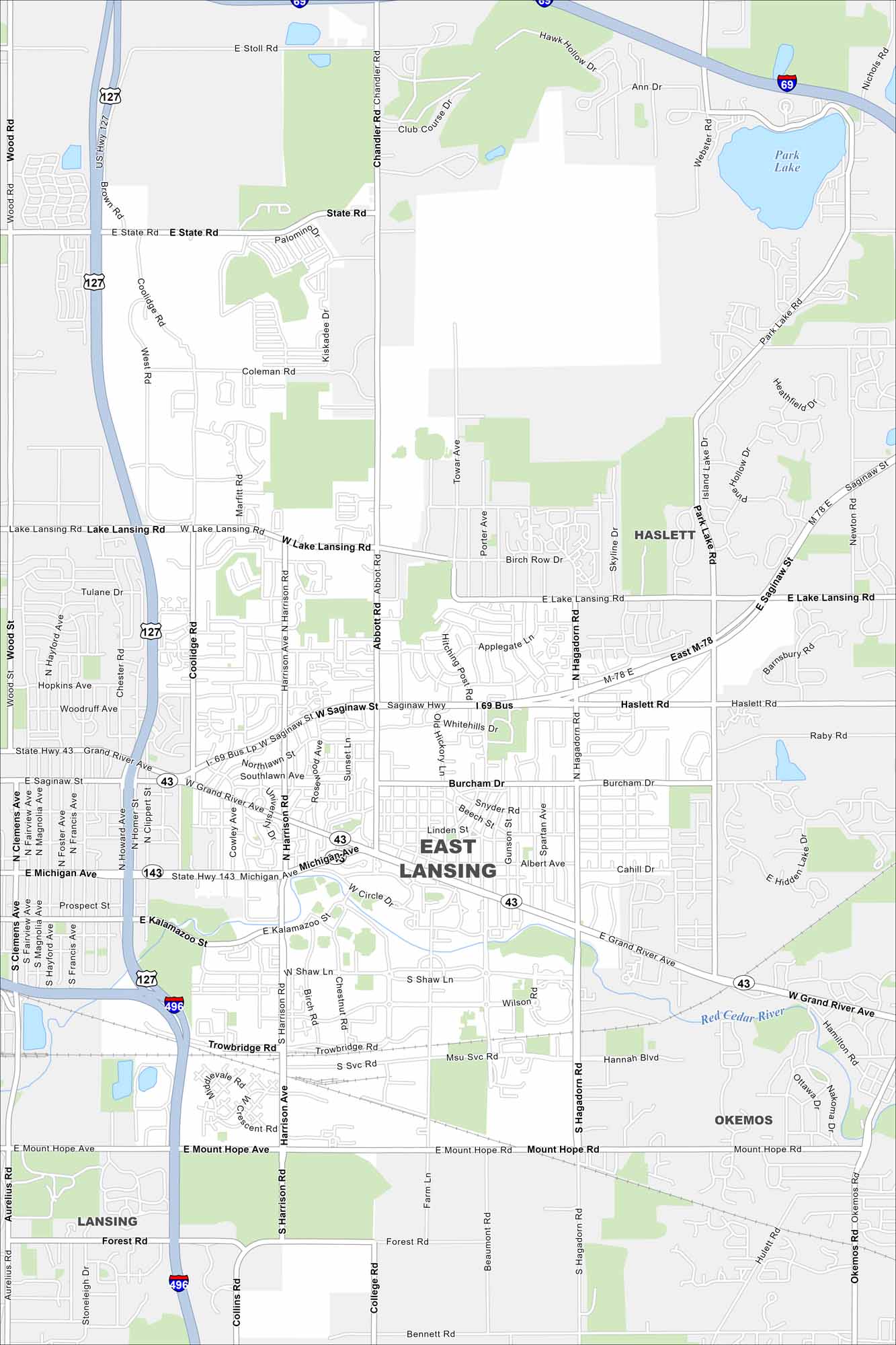
Our map of East Lansing shows the Red Cedar River running through the city. Green spaces and parks stretch along its banks. It’s well known because Michigan State University.
Map Information
On the Map
Interstates/Highways: I-69, I-496, US Hwy 127, State Rte 43 Major Roads: Grand River Ave, Michigan Ave, Saginaw St, Harrison Rd, Abbot Rd, Hagadorn Rd, Lake Lansing Rd, Trowbridge Rd, Mount Hope Ave, Forest Rd, State Rd, Coolidge Rd, Alton Rd, Burcham Dr, Haslett Rd, Okemos Rd, Park Lake Rd, Chandler Rd, Marsh Rd, Jolly Rd Lakes and Reservoirs: Park Lake Major Rivers: Red Cedar River Nearby Communities: Lansing, Haslett, OkemosMichigan State Maps
Get to know Michigan with our detailed maps


City Maps of Michigan
Check out our maps of Detroit and other cities in Michigan


