Map of Endicott, New York
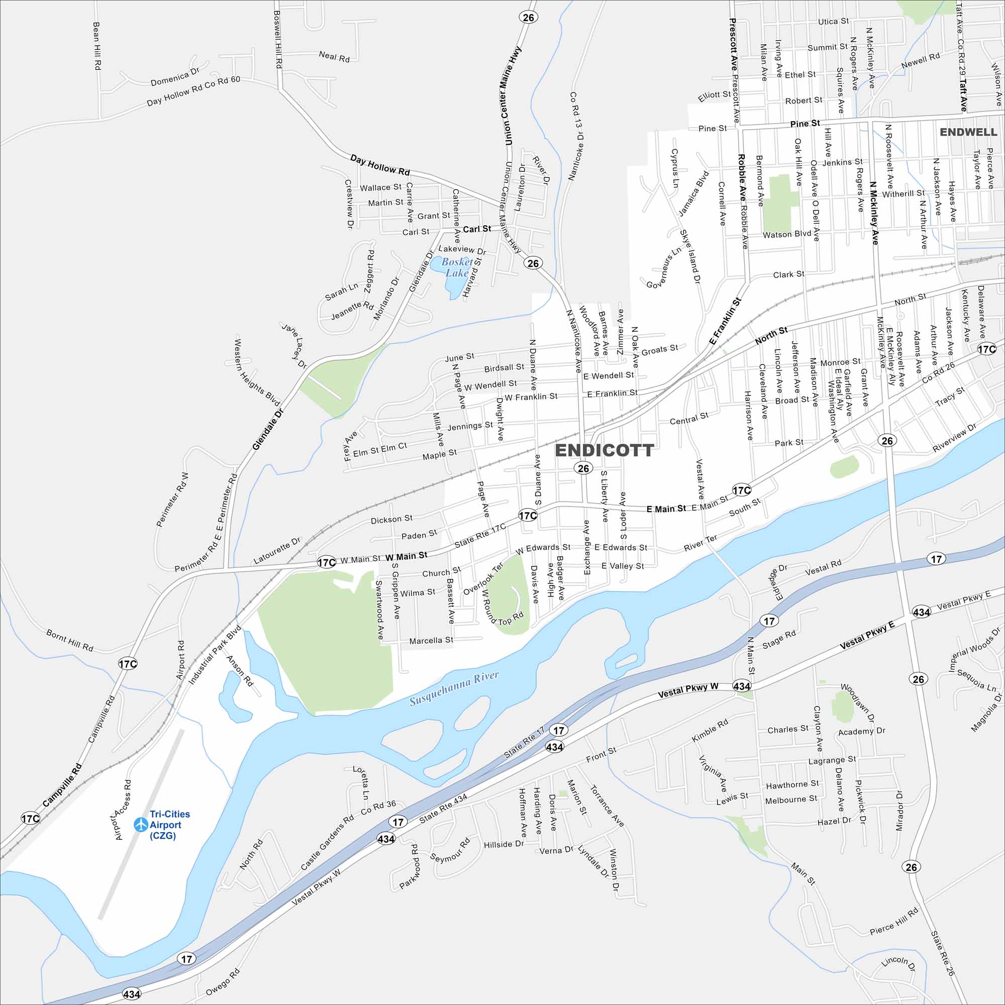
Endicott lies west of Binghamton along the Susquehanna River. Streets spread out on both sides of the water. The river valley gives it a distinct shape.
Map Information
On the Map
Interstates/Highways: State Rte 17, State Rte 26, State Rte 17C, State Rte 434 Major Roads: Main St, Vestal Pkwy, North St, Franklin St, Nanticoke Ave, Union Center Maine Hwy, Watson Blvd, Broad St, Madison Ave, Washington Ave, Riverview Dr, Day Hollow Rd, Western Heights Blvd, Glendale Dr, Airport Rd, Campville Rd, Owego Rd, Stage Rd, Front St, Hillside Dr Airports: Tri-Cities Airport (CZG) Lakes and Reservoirs: Bosket Lake Major Rivers: Susquehanna River Nearby Communities: EndwellNew York State Maps
Find state maps of the Empire State.


City Maps of New York
Here are the city maps that define New York


