Map of Fayetteville, North Carolina
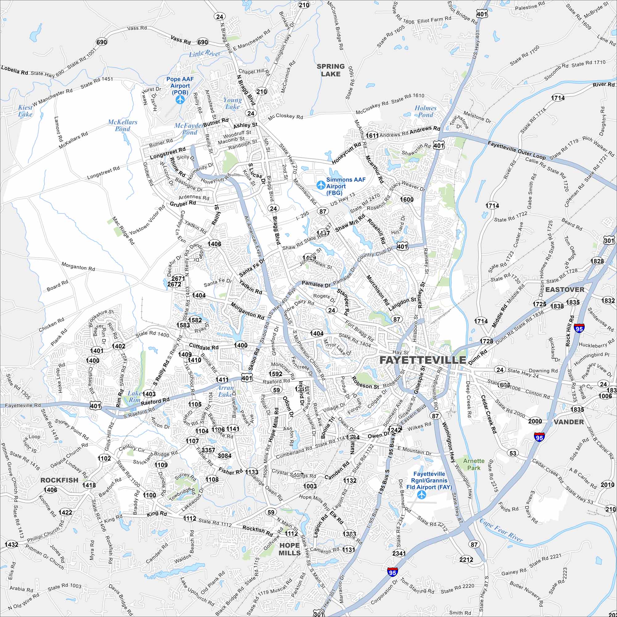
Our map of Fayetteville shows it along the Cape Fear River. Major highways like I-95 run just east of the city. Its river and road network gives it a hub-like feel.
Map Information
On the Map
Interstates/Highways: I-295, I-95, I-95 Bus, US Hwy 401, US Hwy 301, US Hwy 13, State Rte 24, State Rte 87, State Rte 59, State Rte 53, State Rte 210 Major Roads: Raeford Rd, Skibo Rd, Bragg Blvd, Murchison Rd, Ramsey St, Cliffdale Rd, Reilly Rd, Santa Fe Dr, Hope Mills Rd, Owen Dr, Gillespie St, Robeson St, Grove St, Eastern Blvd, All American Expy, Pamalee Dr, Country Club Dr, Morganton Rd, Village Dr, Cumberland Rd Airports: Fayetteville Rgnl/Grannis Fld Airport, Simmons AAF Airport, Pope AAF Airport Lakes and Reservoirs: Lake Rim, Arran Lake, McFayden Pond, McKellars Pond, Kiest Lake, Holmes Pond Major Rivers: Little River, Cape Fear River Parks and Preserves: Arnette Park Nearby Communities: Spring Lake, Hope Mills, Eastover, Vander, RockfishNorth Carolina State Maps
Get to know the mountains and coastlines of North Carolina.


City Maps of North Carolina
Journey through North Carolina with our city maps


