Map of Fort Pierce, Florida
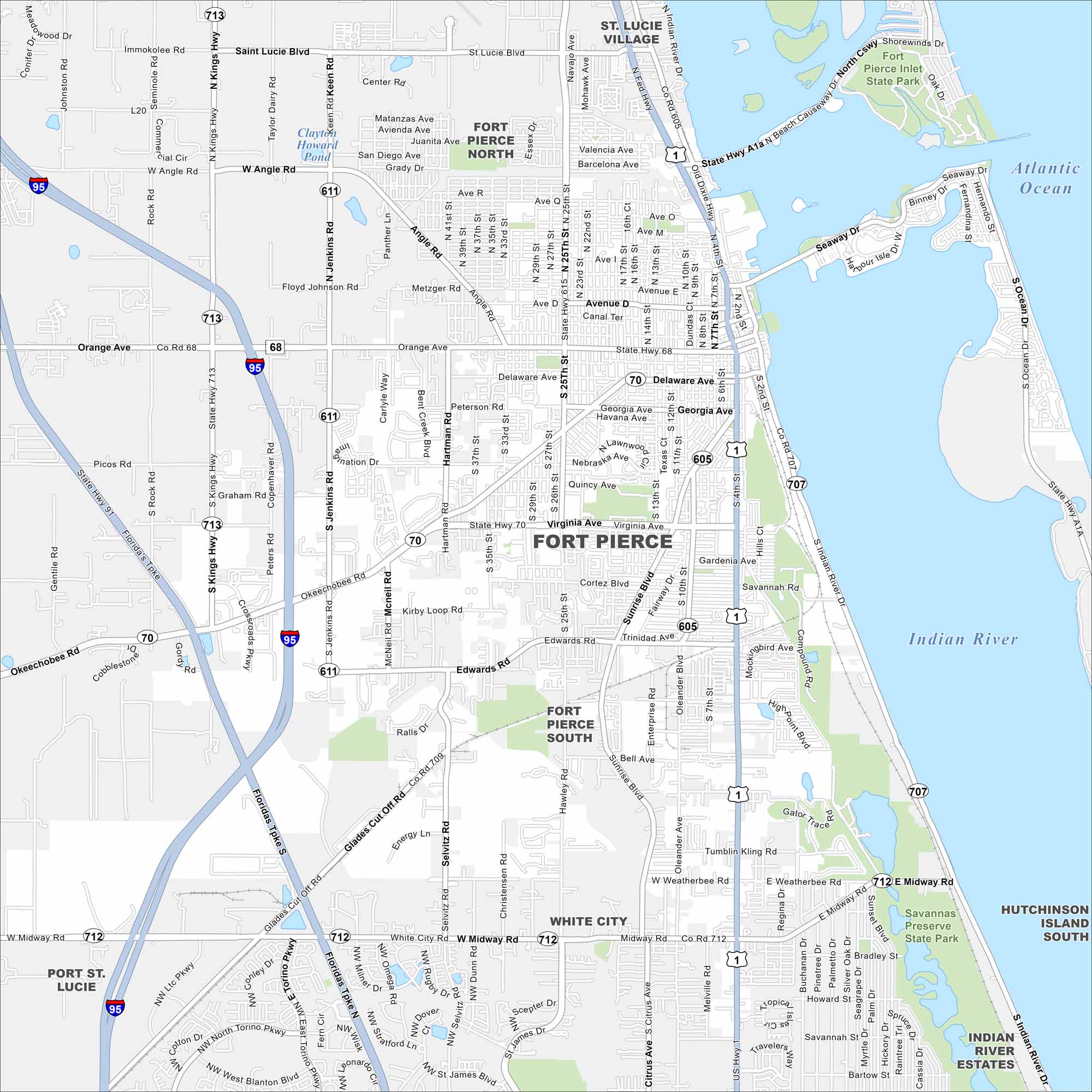
Check out our map of Fort Pierce on the Atlantic coast. The Indian River Lagoon lines the city’s eastern edge. Our map shows I-95 and the Florida Turnpike pass close by.
Florida State Maps
Discover Florida through our state maps


Map Information
On the Map
Interstates/Highways: I-95, US Hwy 1, State Hwy 713, State Hwy 611, State Hwy 70, State Hwy 68, State Hwy 605, State Hwy 615, State Hwy 707, State Hwy 712, State Hwy A1A Major Roads: Okeechobee Rd, Orange Ave, Virginia Ave, Midway Rd, Kings Hwy, Jenkins Rd, 25th St, Delaware Ave, Georgia Ave, Edwards Rd, Weatherbee Rd, Sunrise Blvd, Hartman Rd, Angle Rd, Saint Lucie Blvd, Northport Pkwy, Torino Pkwy, Glades Cut Off Rd, Oleander Ave, Selvitz Rd Lakes and Reservoirs: Atlantic Ocean, Clayton Howard Pond Major Rivers: Indian River Parks and Preserves: Savannas Preserve State Park, Fort Pierce Inlet State Park Nearby Communities: St. Lucie Village, Fort Pierce North, Fort Pierce South, White City, Port St. Lucie, Hutchinson Island South, Indian River EstatesFlorida City Maps
Chart your course through Miami and Florida’s cities


