Map of Freeport, New York
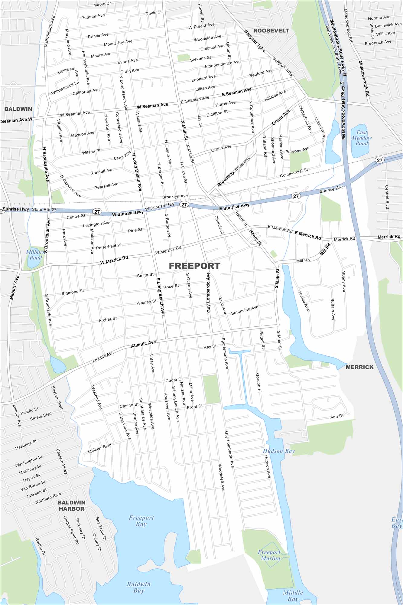
Our map of Freeport shows it right on Long Island’s south shore. Canals cut through neighborhoods toward the bay. The Meadowbrook Parkway provides quick access north.
Map Information
On the Map
Interstates/Highways: State Rte 27 Major Roads: Sunrise Hwy, Meadowbrook State Pkwy, Merrick Rd, Main St, Atlantic Ave, Grand Ave, Guy Lombardo Ave, Long Beach Ave, Seaman Ave, Broadway, Babylon Tpke, Brookside Ave, Mill Rd, Hanse Ave, Buffalo Ave, Sportsmans Ave, Hudson Ave, Woodcleft Ave, Bergen Pl, Ocean Ave Lakes and Reservoirs: Hudson Bay, Freeport Bay, Baldwin Bay, Middle Bay, East Bay, Milburn Pond, East Meadow Pond Nearby Communities: Roosevelt, Baldwin, Merrick, Baldwin HarborNew York State Maps
Find state maps of the Empire State.


City Maps of New York
Here are the city maps that define New York


