Map of Gainesville, Florida
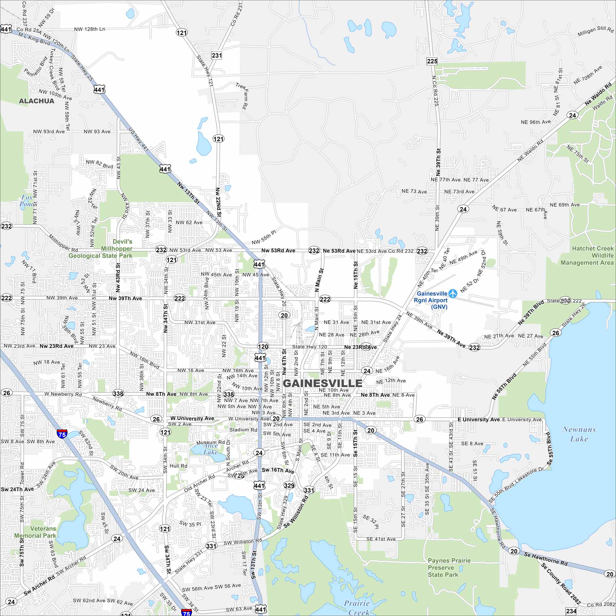
Gainesville is in north-central Florida, home to the University of Florida. This map shows lakes, creeks, and state parks. Highways link it across flat, green land.
Florida State Maps
Discover Florida through our state maps


Map Information
On the Map
Interstates/Highways: I-75, US Hwy 441, US Hwy 301, US Hwy 121, State Hwy 24, State Hwy 20, State Hwy 120, State Hwy 222, State Hwy 26, State Hwy 331, State Hwy 329 Major Roads: University Ave, Main St, 13th St, 34th St, 39th Ave, Archer Rd, Williston Rd, Waldo Rd, Newberry Rd, 53rd Rd, 8th Ave, 16th Ave, Hawthorne Rd, NW 43rd St, SW 75th St, Tower Rd, 23rd Ave, NE 15th St, SE 4th St, Hull Rd Airports: Gainesville Rgnl Airport (GNV) Lakes and Reservoirs: Newnans Lake, Alice Lake Major Rivers: Prairie Creek Parks and Preserves: Paynes Prairie Preserve State Park, Devil’s Millhopper Geological State Park, Hatchet Creek Wildlife Management Area, Veterans Memorial Park Nearby Communities: AlachuaFlorida City Maps
Chart your course through Miami and Florida’s cities


