Map of Goldsboro, North Carolina
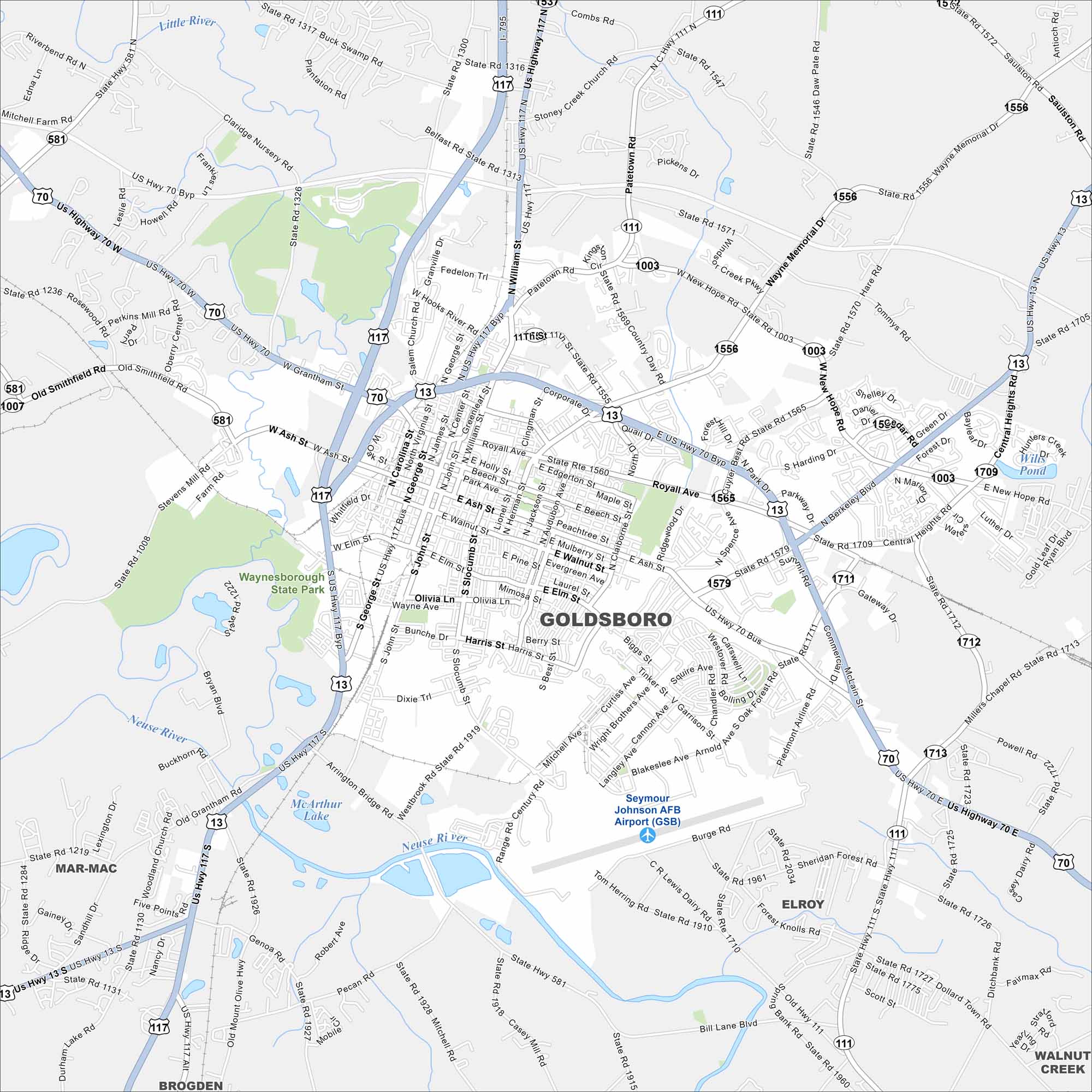
Goldsboro stretches along the Neuse River in eastern North Carolina. It’s tied closely to Seymour Johnson Air Force Base. The river and open fields spread out around it.
Map Information
On the Map
Interstates/Highways: US Hwy 70, US Hwy 13, US Hwy 117, State Rte 581, State Rte 111 Major Roads: Ash St, Grantham St, Wayne Memorial Dr, New Hope Rd, Berkeley Blvd, Central Heights Rd, McLain St, Landmark Dr, George St, William St, Center St, John St, Slocumb St, Elm St, Walnut St, Holly St, Park Ave, Mulberry St, Mimosa St, Pine St Airports: Seymour Johnson AFB Airport (GSB) Lakes and Reservoirs: McArthur Lake, Wilk Pond Major Rivers: Little River, Neuse River Parks and Preserves: Waynesborough State Park Nearby Communities: Mar-Mac, Brogden, Elroy, Walnut CreekNorth Carolina State Maps
Get to know the mountains and coastlines of North Carolina.


City Maps of North Carolina
Journey through North Carolina with our city maps


