Map of Grand Rapids, Michigan
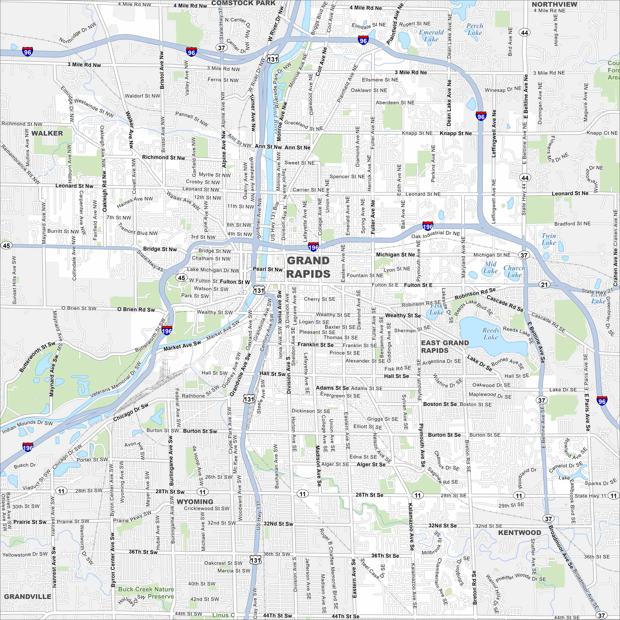
Our map of Grand Rapids follows the Grand River winding through downtown. Highways, parks, and neighborhoods stretch on both sides. The city is known as “Beer City USA” because of its craft breweries.
Map Information
On the Map
Interstates/Highways: I-196, I-96, US Hwy 131, State Rte 44, State Rte 37, State Rte 21, State Rte 11 Major Roads: 28th St, Beltline Ave, Division Ave, Leonard St, Michigan St, Fulton St, Wealthy St, Franklin St, Hall St, Burton St, 36th St, 44th St, Alpine Ave, Plainfield Ave, Knapp St, Fuller Ave, College Ave, Grandville Ave, Chicago Dr, Byron Center Ave Airports: Lakes and Reservoirs: Reeds Lake, Fisk Lake, Emerald Lake, Perch Lake, Mid Lake, Church Lake, Echo Lake, Twin Lake, Sparks Lake, Camelot Lake, Eastbrook Lake Major Rivers: Grand River Parks and Preserves: Buck Creek Nature Preserve Nearby Communities: Wyoming, Kentwood, East Grand Rapids, Grandville, Walker, Comstock Park, NorthviewMichigan State Maps
Get to know Michigan with our detailed maps


City Maps of Michigan
Check out our maps of Detroit and other cities in Michigan


