Map of Greenacres, Florida
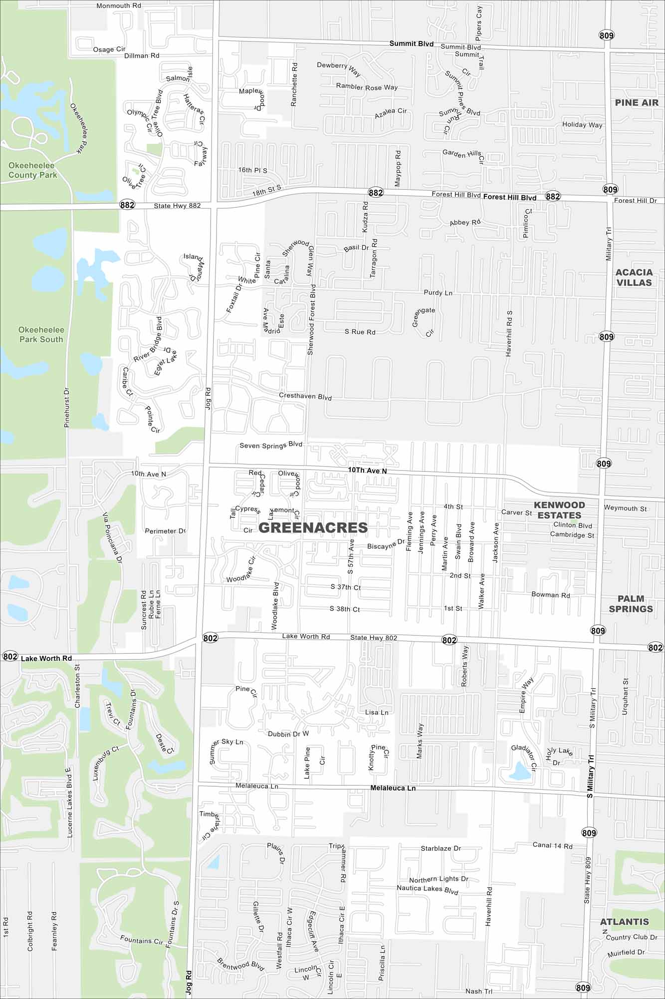
Our map of Greenacres places it inland in Palm Beach County. Neighborhoods fill the inner city grid. Larger roads connect it to the Atlantic Coast.
Florida State Maps
Discover Florida through our state maps


Map Information
On the Map
Interstates/Highways: State Hwy 882, State Hwy 802, State Hwy 809 Major Roads: Jog Rd, Military Trl, Forest Hill Blvd, Lake Worth Rd, 10th Ave N, Melaleuca Ln, Summit Blvd, Cresthaven Blvd, Haverhill Rd, Sherwood Forest Blvd, Dillman Rd, 4th St, 2nd St, 1st St, Lucerne Lakes Blvd, Fountains Dr, Suncrest Rd, Purple Dr, Purdy Ln, Seven Springs Blvd Parks and Preserves: Okeeheelee County Park, Okeeheelee Park South Nearby Communities: Pine Air, Acacia Villas, Kenwood Estates, Palm Springs, AtlantisFlorida City Maps
Chart your course through Miami and Florida’s cities


