Map of Greensboro, North Carolina
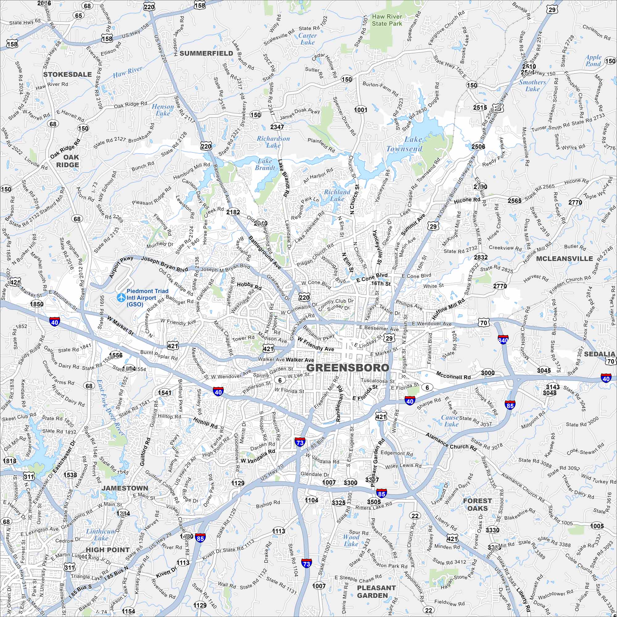
Explore our map of Greensboro in central North Carolina. Interstates 40, 85, and 73 all meet here. Lakes and green spaces surround the area.
Map Information
On the Map
Interstates/Highways: I-40, I-85, I-73, US Hwy 220, US Hwy 421, US Hwy 29, US Hwy 70, State Rte 68, State Rte 150, State Rte 65, State Rte 158, State Rte 62, State Rte 22 Major Roads: Wendover Ave, Market St, Friendly Ave, Battleground Ave, Cone Blvd, Bessemer Ave, Lee St, Florida St, High Point Rd, Freeman Mill Rd, Eugene St, Elm St, Murrow Blvd, Summit Ave, Yanceyville St, Church St, Lawndale Dr, Holden Rd, Patterson St, Randleman Rd Airports: Piedmont Triad Intl Airport (GSO) Lakes and Reservoirs: Lake Brandt, Lake Townsend, Lake Higgins, Richland Lake, Richardson Lake, Carter Lake, Apple Pond, Smothers Lake, Cause State Road Lake, Wood Lake Major Rivers: East Fork Deep River Parks and Preserves: Haw River State Park Nearby Communities: Summerfield, Stokesdale, Oak Ridge, McLeansville, Sedalia, Pleasant Garden, Forest Oaks, Jamestown, High PointNorth Carolina State Maps
Get to know the mountains and coastlines of North Carolina.


City Maps of North Carolina
Journey through North Carolina with our city maps


