Map of Haines City, Florida
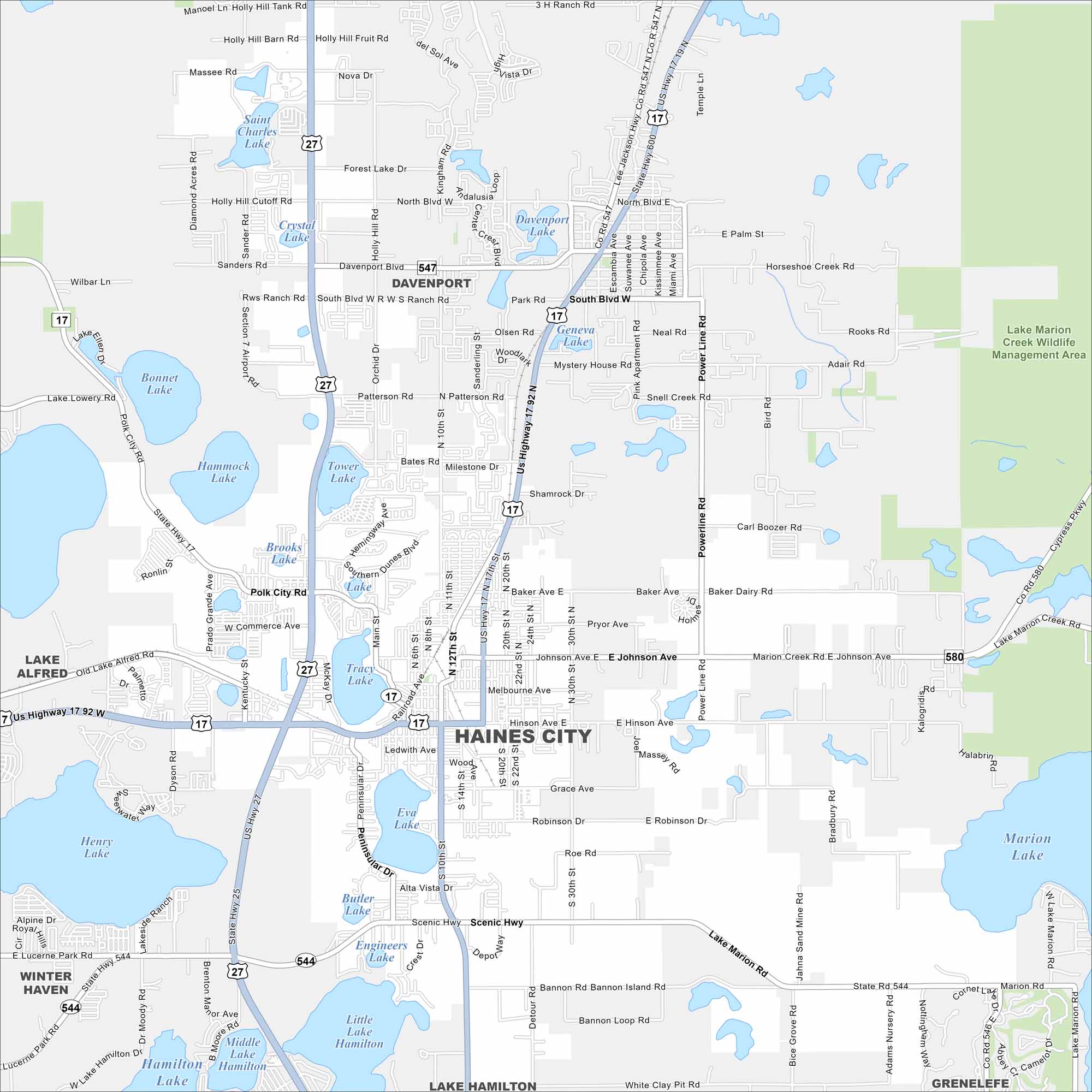
Take a look at our map of Haines City in central Florida. You’ll notice lakes scattered throughout the area. Highways link it to Orlando and Lakeland.
Florida State Maps
Discover Florida through our state maps


Map Information
On the Map
Interstates/Highways: US Hwy 27, US Hwy 17 92, US Hwy 17 Major Roads: 10th St, Bannon Island Rd, Hinson Ave, Johnson Ave, Patterson Rd, Power Line Rd, Old Lake Alfred Rd, Polk City Rd, Detour Rd, Scenic Hwy, Marion Creek Rd, Cypress Pkwy, Lake Marion Rd, Bice Grove Rd Lakes and Reservoirs: Lake Marion, Lake Hamilton, Middle Lake Hamilton, Little Lake Hamilton, Henry Lake, Eva Lake, Butler Lake, Engineers Lake, Tracy Lake, Tower Lake, Brooks Lake, Hammock Lake, Bonnet Lake, Lake Lowery, Crystal Lake, Saint Charles Lake, Davenport Lake, Geneva Lake, Shamrock Lake, South Lake Parks and Preserves: Lake Marion Creek Wildlife Management Area Nearby Communities: Haines City, Davenport, Winter Haven, Lake Alfred, Lake Hamilton, GrenelefeFlorida City Maps
Chart your course through Miami and Florida’s cities


