Map of Hempstead, New York
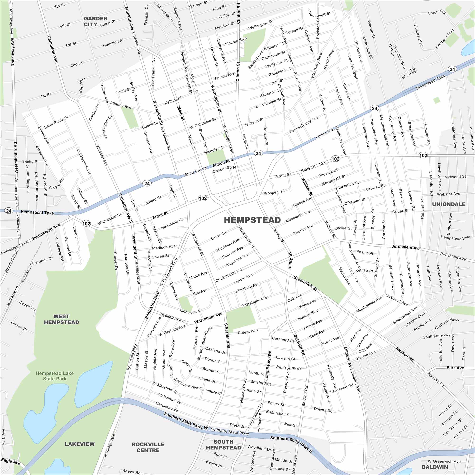
Our map of Hempstead places it on Long Island, just east of New York City. Major parkways run across the area with Hempstead Lake Sate Park on the west side. It’s close to both bays and the Atlantic shoreline.
Map Information
On the Map
Interstates/Highways: Southern State Pkwy, State Rte 24, State Rte 102 Major Roads: Hempstead Tpke, Fulton Ave, Front St, Peninsula Blvd, Clinton Rd, Washington Ave, Main St, Franklin Ave, Cathedral Ave, Greenwich St, Henry St, Uniondale Ave, Jerusalem Ave, President St, Terrace Ave, Bedell St, Marshall St, Graham Ave, Jackson St, Orchard St Parks and Preserves: Hempstead Lake State Park Nearby Communities: Garden City, West Hempstead, Hempstead, Uniondale, Lakeview, Rockville Centre, South Hempstead, BaldwinNew York State Maps
Find state maps of the Empire State.


City Maps of New York
Here are the city maps that define New York


