Map of White Plains, New York
Get to know White Plains, a busy hub in Westchester County. The city blends shopping, business, and suburban neighborhoods. See it all with our map.
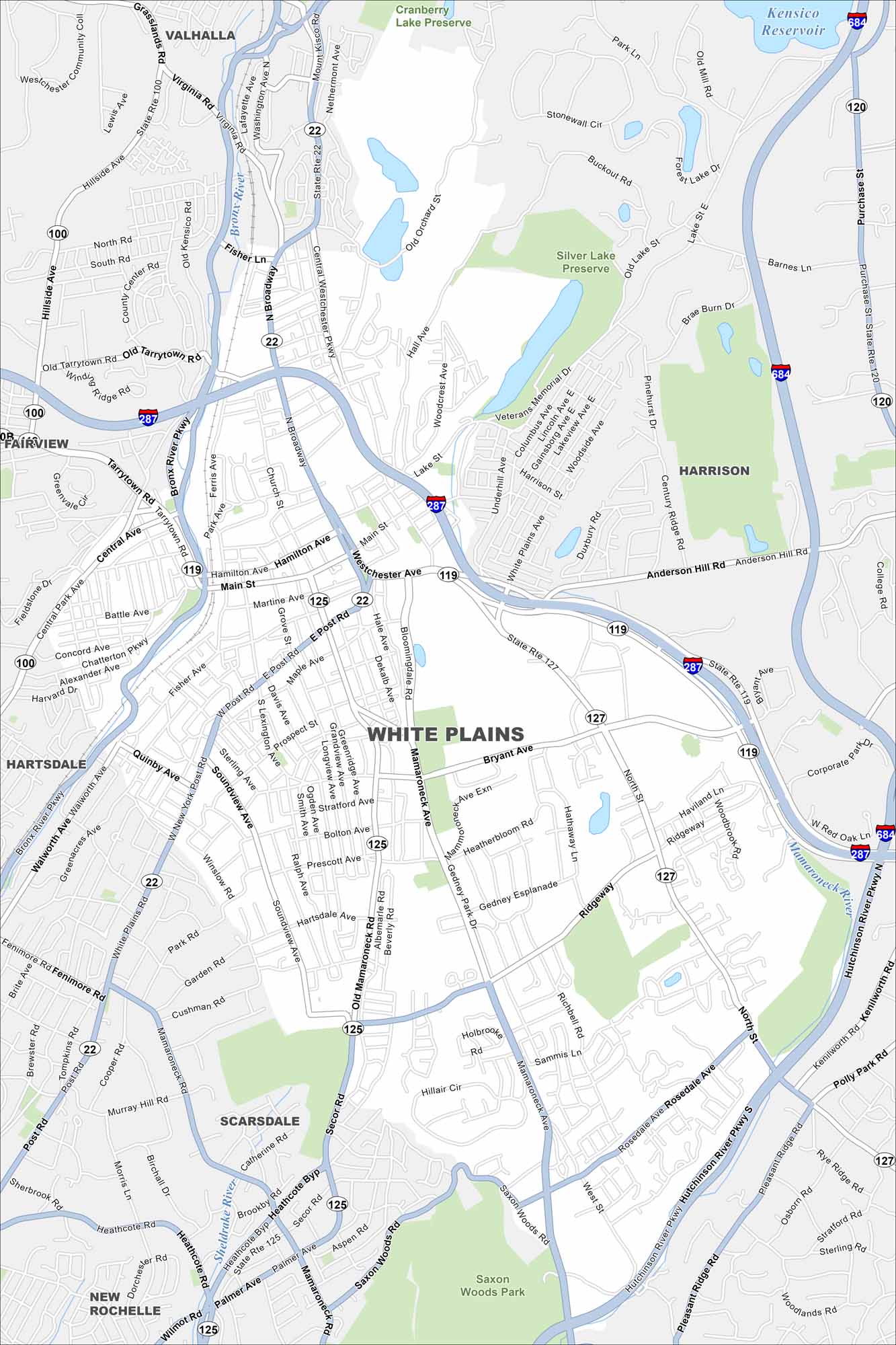
Map Information
On the Map
Interstates/Highways: I-287, I-687, I-684, State Rte 22, State Rte 125, State Rte 127, State Rte 120, State Rte 100 Major Roads: Mamaroneck Ave, Westchester Ave, Main St, Post Rd, Bryant Ave, North St, Tarrytown Rd, Central Ave, Broadway, Hutchinson River Pkwy, Bronx River Pkwy, Kenilworth Rd, Anderson Hill Rd, Purchase St, Lake St, Old Orchard St, North St, Hillside Ave, Ferris Ave, Church St Lakes and Reservoirs: Kensico Reservoir Major Rivers: Mamaroneck River, Sheldrake River, Bronx River Parks and Preserves: Saxon Woods Park, Silver Lake Preserve, Cranberry Lake Preserve Nearby Communities: Valhalla, Harrison, Fairview, Hartsdale, Scarsdale, New RochelleNew York State Maps
Find state maps of the Empire State.


City Maps of New York
Here are the city maps that define New York


