Map of Hialeah, Florida
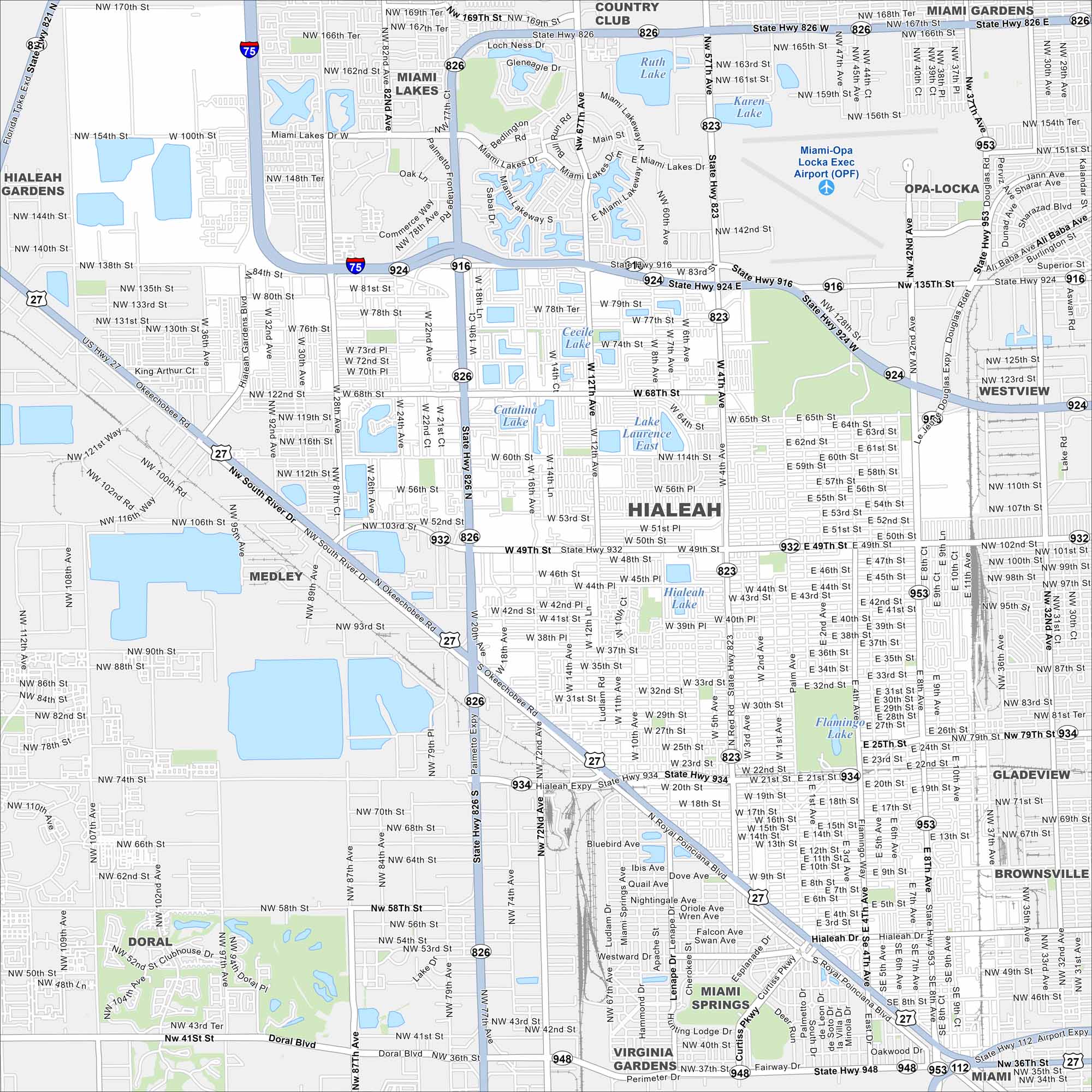
Hialeah sits in South Florida, just northwest of Miami. Our map shows a dense grid of streets. Major highways cut across the city, linking it to the coast.
Florida State Maps
Discover Florida through our state maps


Map Information
On the Map
Interstates/Highways: I-75, US Hwy 27, State Rte 826, State Rte 924, State Rte 916, State Rte 932, State Rte 934, State Rte 948, State Rte 953 Major Roads: Okeechobee Rd, Palmetto Expy, Hialeah Expy, Red Rd, Ludlam Rd, Flamingo Way, Palm Ave, Curtiss Pkwy, East 4th Ave, West 4th Ave, W 49th St, W 12th Ave, W 8th Ave, W 20th Ave, NW 103rd St, NW 79th St, NW 54th St, NW 36th St, NW 138th St, NW 27th Ave Airports: Miami-Opa Locka Exec Airport (OPF) Lakes and Reservoirs: Catalina Lake, Lake Laurence East, Flamingo Lake, Cecile Lake, Ruth Lake, Karen Lake Nearby Communities: Medley, Miami Springs, Virginia Gardens, Doral, Opa-Locka, Miami Lakes, Westview, Gladeview, Brownsville, Miami Gardens, Country Club, Hialeah GardensFlorida City Maps
Chart your course through Miami and Florida’s cities


