Map of Kalamazoo, Michigan
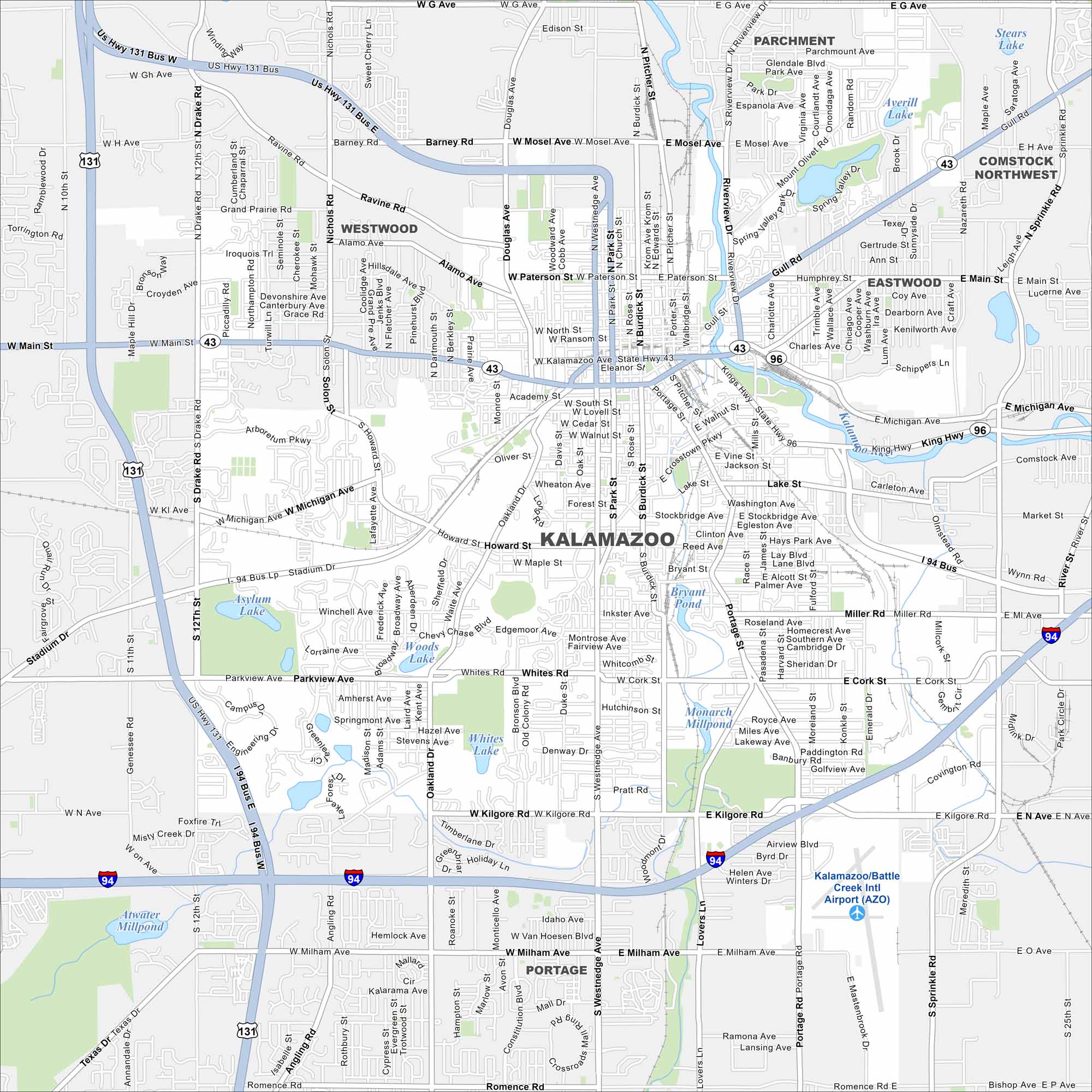
Our map of Kalamazoo shows a downtown split by the Kalamazoo River. Colleges and breweries cluster near the center. Highways link the city to Lake Michigan and Detroit.
Map Information
On the Map
Interstates/Highways: I-94, US Hwy 131, State Rte 43, State Rte 96 Major Roads: Westnedge Ave, Michigan Ave, Stadium Dr, Main St, Drake Rd, Parkview Ave, Kilgore Rd, Milham Ave, Romence Rd, Gull Rd, Riverview Dr, Portage Rd, Cork St, Miller Rd, Whites Rd, Howard St, Oakland Dr, Paterson St, Mosel Ave, Mt Olivet Rd Airports: Kalamazoo/Battle Creek Intl Airport (AZO) Lakes and Reservoirs: Asylum Lake, Woods Lake, Whites Lake, Bryant Pond, Monarch Millpond, Atwater Millpond, Stears Lake, Averill Lake Major Rivers: Kalamazoo River Nearby Communities: Portage, Parchment, Westwood, Eastwood, Comstock Northwest, ComstockMichigan State Maps
Get to know Michigan with our detailed maps


City Maps of Michigan
Check out our maps of Detroit and other cities in Michigan


