Map of Kingston, New York
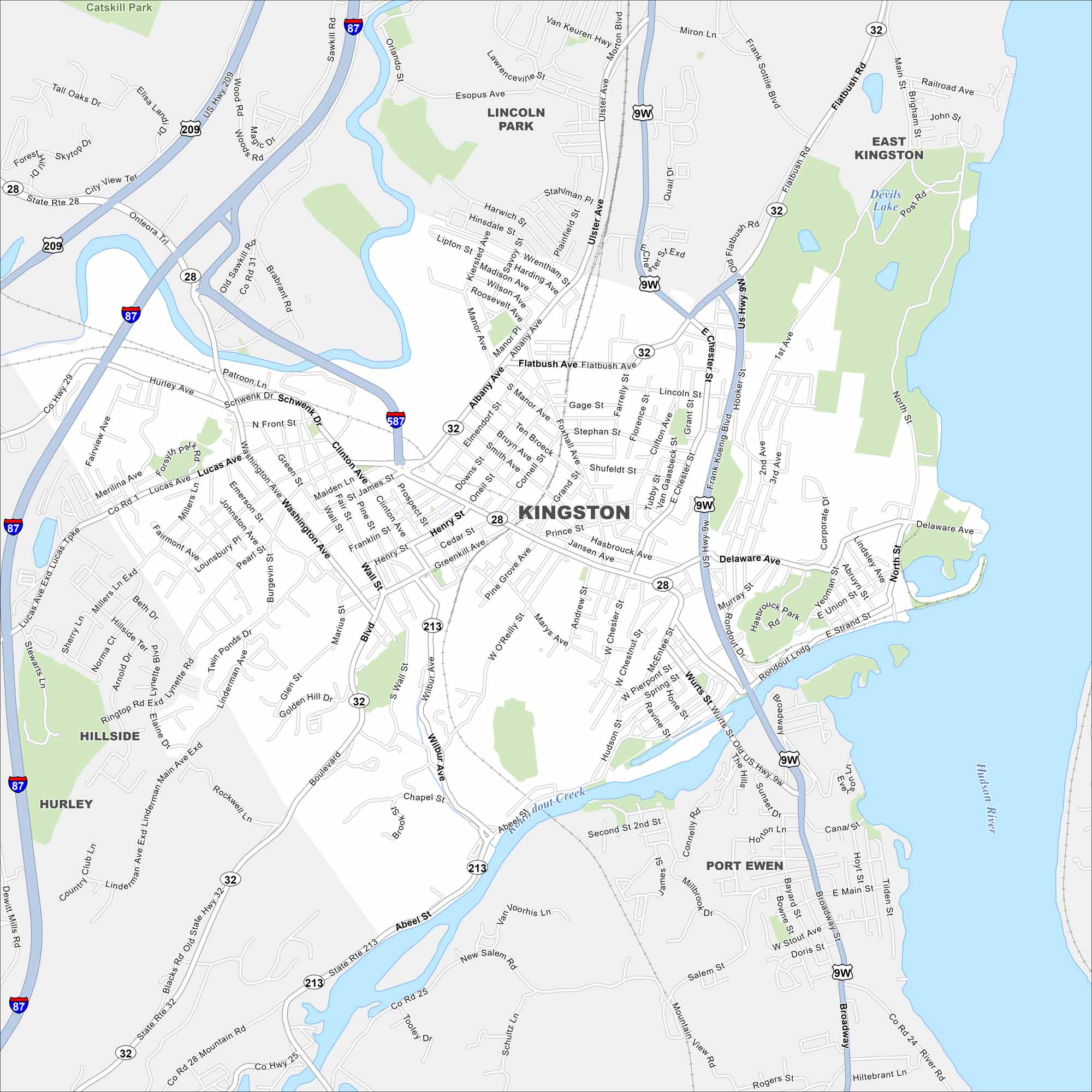
Kingston sits on the Hudson River, just below the Catskills. Our map shows old neighborhoods clustered near the water. Roads and highways connect folks to the nearby mountains.
Map Information
On the Map
Interstates/Highways: I-87, US Hwy 209, US Hwy 9W, State Rte 28, State Rte 32, State Rte 213, State Rte 587 Major Roads: Albany Ave, Broadway, Ulster Ave, Flatbush Ave, Clinton Ave, Washington Ave, Lucas Ave, Foxhall Ave, Wilbur Ave, Abeel St, Murray St, Delaware Ave, Esopus Ave, Linderman Ave, Main St, Greenkill Ave, Henry St, Prospect St, Wall St, Fair St Lakes and Reservoirs: Devils Lake Major Rivers: Hudson River Parks and Preserves: Catskill Park Nearby Communities: Lincoln Park, East Kingston, Kingston, Port Ewen, Hurley, HillsideNew York State Maps
Find state maps of the Empire State.


City Maps of New York
Here are the city maps that define New York


