Map of Wilmington, North Carolina
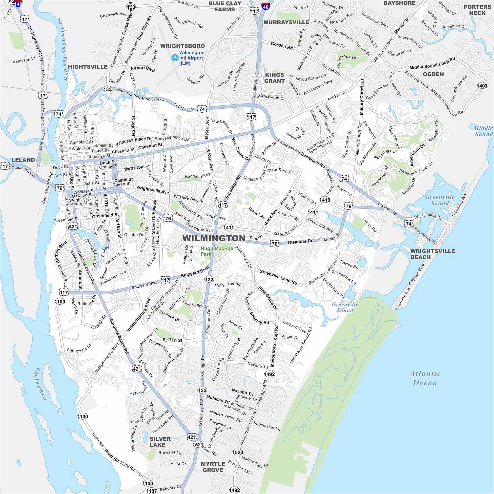
See the streets of Wilmington sandwiched between the Cape Fear River and the Atlantic Ocean. Beaches and a historic downtown make it a coastal hub. Our map shows how it connects to the rest of North Carolina.
Map Information
On the Map
Interstates/Highways: I-140, US Hwy 17, US Hwy 17 Bus, US Hwy 74, US Hwy 76, US Hwy 117, US Hwy 421, State Rte 132, State Rte 133 Major Roads: Market St, Oleander Dr, College Rd, Military Cutoff Rd, Wrightsville Ave, Independence Blvd, Carolina Beach Rd, Shipyard Blvd, Martin Luther King Jr Pkwy, Eastwood Rd, Princess Place Dr, Front St, 3rd St, 16th St, 23rd St, Kerr Ave, Wilshire Blvd, Greenville Loop Rd, Masonboro Loop Rd, Piner Rd Airports: Wilmington Intl Airport (ILM) Lakes and Reservoirs: Atlantic Ocean, Greenville Sound, Middle Sound Major Rivers: Cape Fear River, Northeast Cape Fear River Parks and Preserves: Hugh MacRae Park Nearby Communities: Hightsville, Wrightsboro, Blue Clay Farms, Murraysville, Kings Grant, Bayshore, Porters Neck, Ogden, Wrightsville Beach, Myrtle Grove, Silver Lake, LelandNorth Carolina State Maps
Get to know the mountains and coastlines of North Carolina.


City Maps of North Carolina
Journey through North Carolina with our city maps


