Map of Largo, Florida
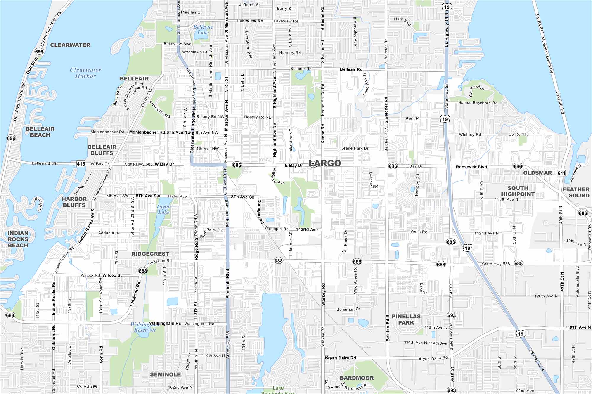
Largo appears in the heart of Pinellas County. This map shows it squeezed between Clearwater and St. Petersburg. Lakes and green parks cover the cityscape.
Florida State Maps
Discover Florida through our state maps


Map Information
On the Map
Interstates/Highways: US Hwy 19 Major Roads: Bay Dr, W Bay Dr, E Bay Dr, Ulmerton Rd, Roosevelt Blvd, East Bay Dr, Seminole Blvd, Missouri Ave, S Missouri Ave, Keene Rd, S Keene Rd, Belcher Rd, S Belcher Rd, Starkey Rd, Bryan Dairy Rd, 66th St, 113th St, Ridge Rd, Indian Rocks Rd, Oakhurst Rd Lakes and Reservoirs: Clearwater Harbor, Bellevue Lake, Taylor Lake, Lake Seminole, Walsingham Reservoir Nearby Communities: Clearwater, Belleair, Belleair Bluffs, Belleair Beach, Harbor Bluffs, Indian Rocks Beach, Ridgecrest, Seminole, Pinellas Park, Bardmoor, South Highpoint, Oldsmar, Feather SoundFlorida City Maps
Chart your course through Miami and Florida’s cities


