Map of Leesburg, Florida
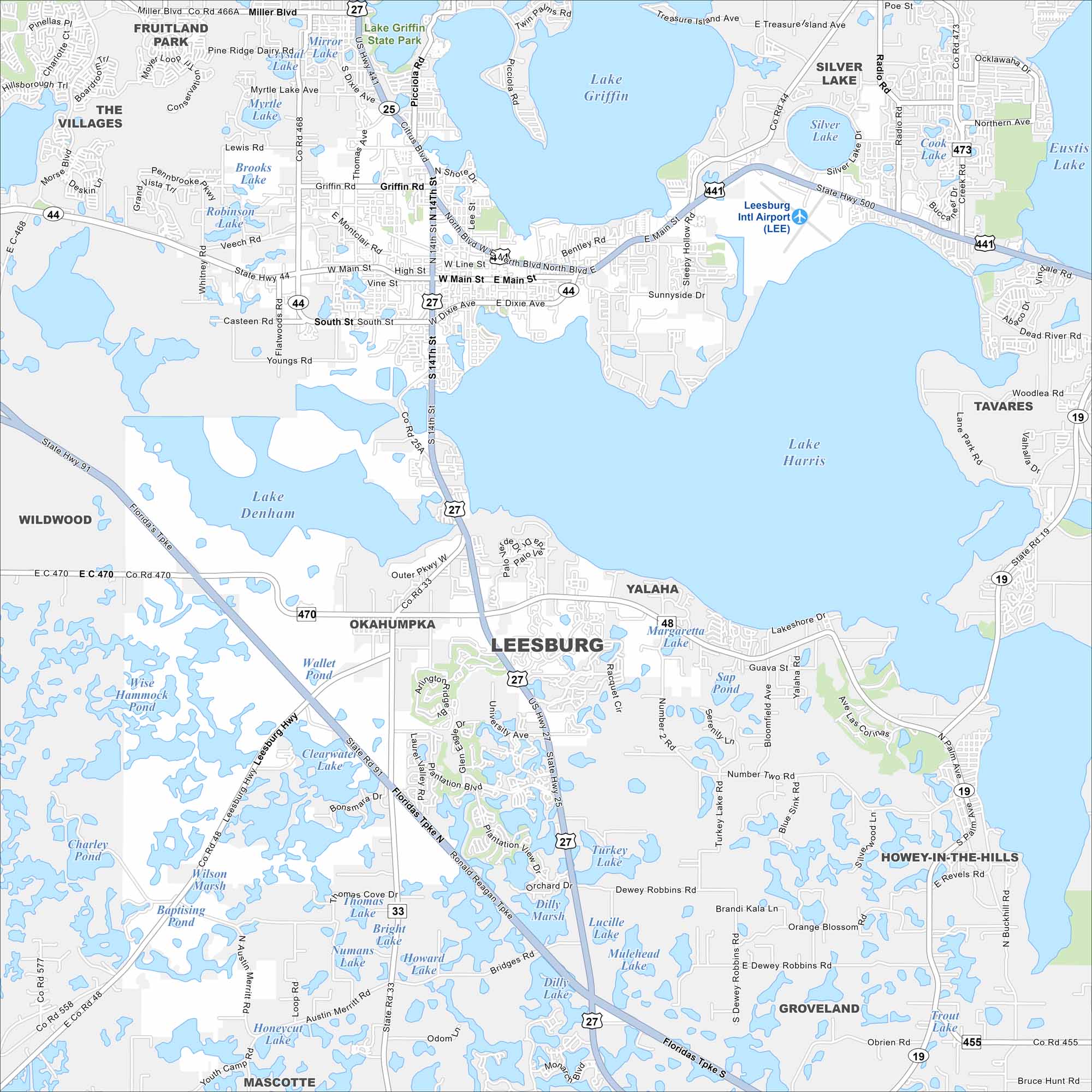
Our map shows Leesburg, Florida which stands between Lake Harris and Lake Griffin. Downtown streets cluster near the shoreline. Water defines its edges and city altogether.
Florida State Maps
Discover Florida through our state maps


Map Information
On the Map
Interstates/Highways: Florida’s Tpke, Ronald Reagan Tpke, US Hwy 27, US Hwy 441, State Hwy 44 Major Roads: Main St, Dixie Ave, State Hwy 91, State Rd 19, State Rd 33, State Rd 25A, Citrus Blvd, Main St, South St, Thomas Ave, Radio Rd, Eurekea St, Sleepy Hollow Rd, Lakeshore Dr, University Ave, Palm Ave, Miller Blvd Airports: Leesburg Intl Airport (LEE) Lakes and Reservoirs: Lake Harris, Lake Griffin, Lake Denham, Silver Lake, Eustis Lake, Mirror Lake, Myrtle Lake, Brooks Lake, Clearwater Lake, Thomas Lake, Bright Lake, Howard Lake, Numans Lake, Turkey Lake, Dilly Marsh, Lucille Lake, Mulehead Lake, Trout Lake, Sap Pond, Bloomfield Ave Lake Parks and Preserves: Lake Griffin State Park Nearby Communities: Fruitland Park, The Villages, Wildwood, Okahumpka, Yalaha, Tavares, Groveland, Mascotte, Howey-In-The-Hills, Silver LakeFlorida City Maps
Chart your course through Miami and Florida’s cities


