Map of Marathon, Florida
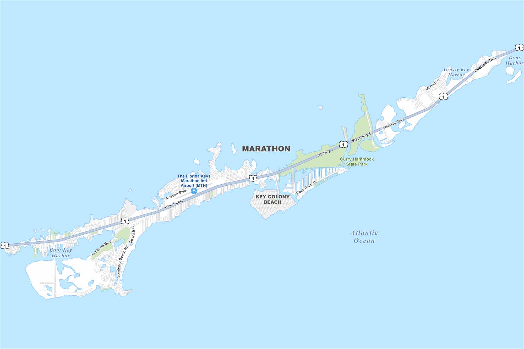
Our map of Marathon shows its location along the Florida Keys and US-1. Bridges connect its islands across turquoise waters. The Gulf and Atlantic surround the narrow city.
Florida State Maps
Discover Florida through our state maps


Map Information
On the Map
Interstates/Highways: US Hwy 1, Overseas Hwy, State Hwy 5 Major Roads: Sombrero Beach Rd, Aviation Blvd, Rick Turner, Sombrero Blvd, Coco Plum Dr, Morton St Airports: The Florida Keys Marathon Intl Airport (MTH) Lakes and Reservoirs: Atlantic Ocean, Boot Key Harbor, Toms Harbor, Grassy Key Harbor Parks and Preserves: Curry Hammock State Park Nearby Communities: Key Colony BeachFlorida City Maps
Chart your course through Miami and Florida’s cities


