Map of Marco Island, Florida
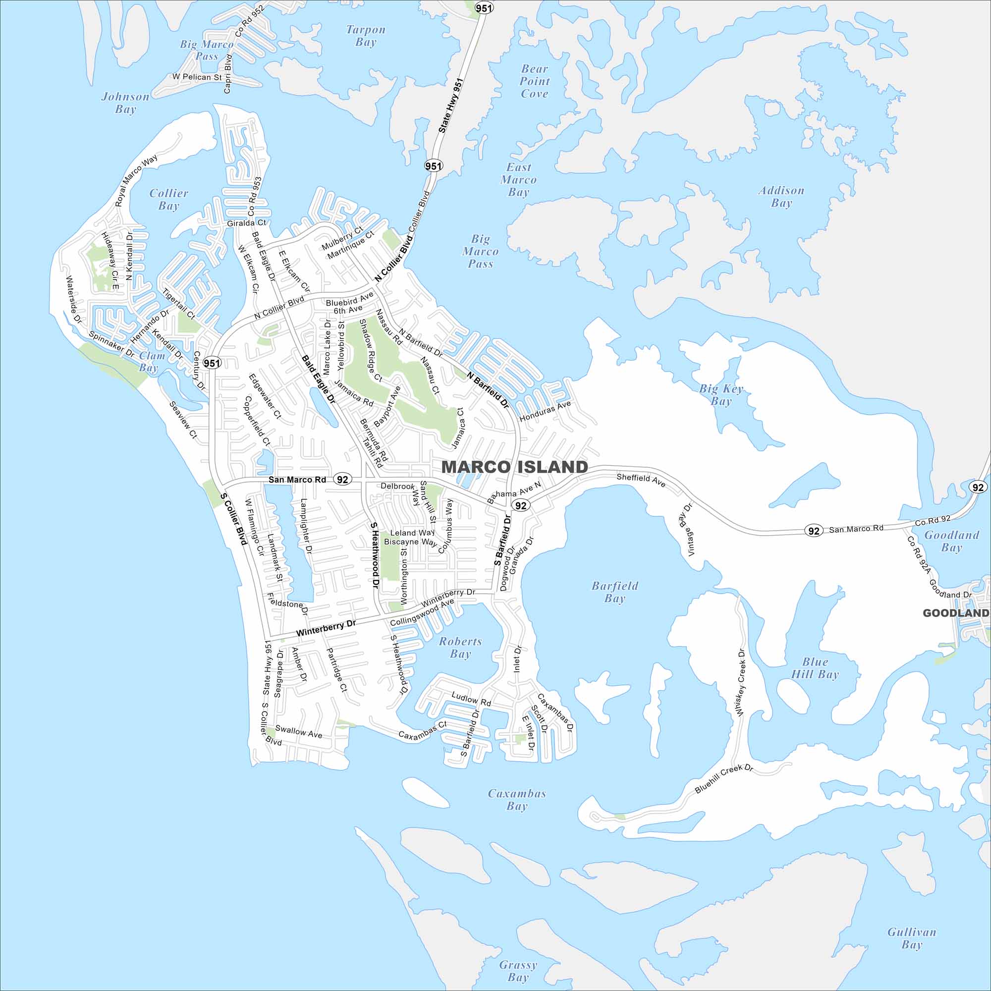
Our map of Marco Island shows its grid of canals and waterfront streets. The Gulf Coast borders the city to the west. Bridges connect it to the mainland across the mangroves.
Florida State Maps
Discover Florida through our state maps


Map Information
On the Map
Interstates/Highways: State Hwy 951, State Hwy 92 Major Roads: Collier Blvd, San Marco Rd, Barfield Dr, Bald Eagle Dr, Winterberry Dr, Caxambas Dr, Heathwood Dr, E Elkcam Cir, N Collier Blvd, S Collier Blvd, Seaview Ct, Spinnaker Dr, Kendall Dr, Tigertail Ct, Hernando Dr, Royal Marco Way, Capri Blvd, Jolley Bridge Lakes and Reservoirs: Barfield Bay, Roberts Bay, Caxambas Bay, Grassy Bay, Gullivan Bay, Blue Hill Bay, Goodland Bay, Big Key Bay, Big Marco Pass, East Marco Bay, Addison Bay, Bear Point Cove, Tarpon Bay, Johnson Bay, Collier Bay, Clam Bay Nearby Communities: GoodlandFlorida City Maps
Chart your course through Miami and Florida’s cities


