Map of Winter Haven, Florida
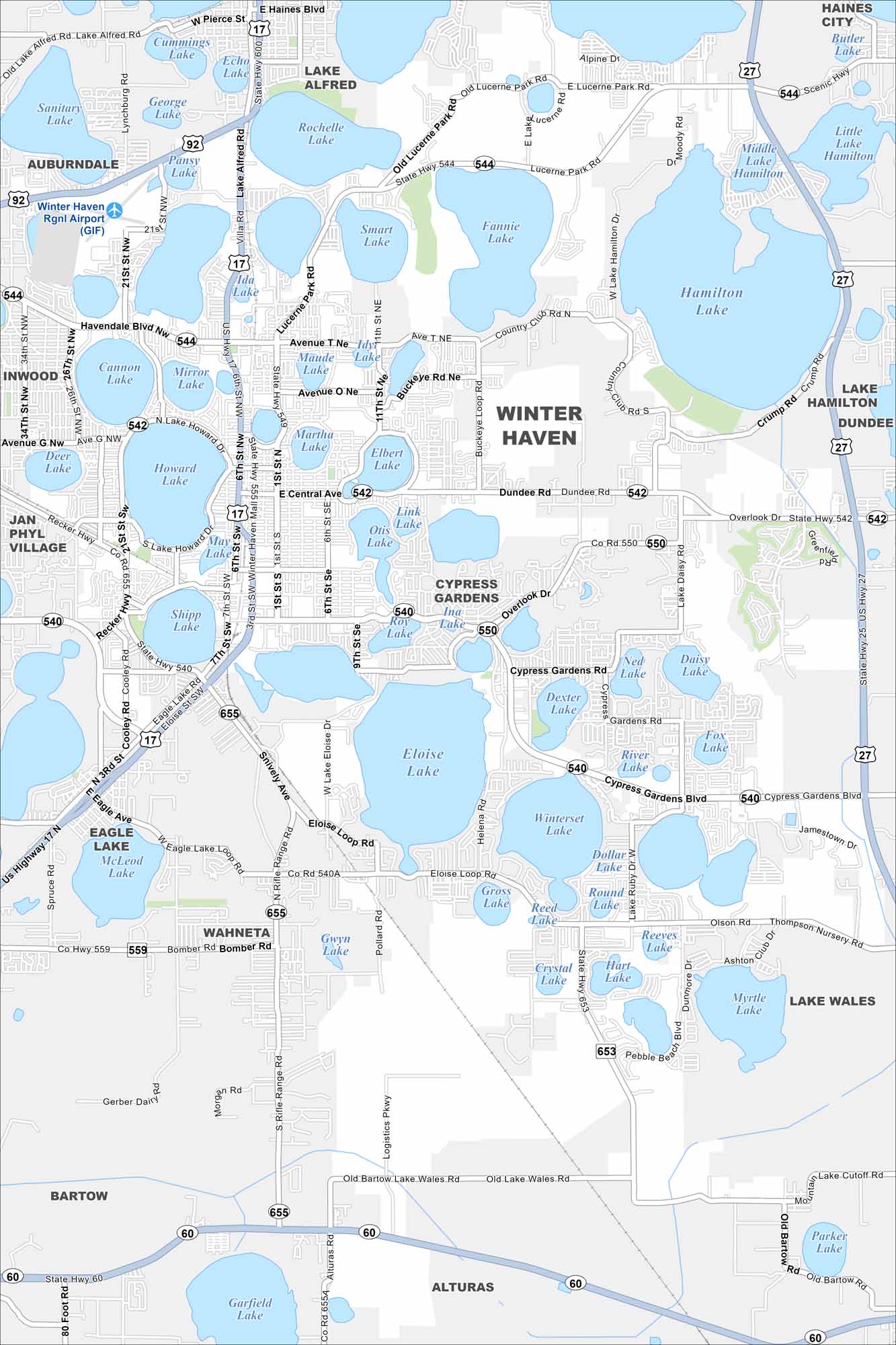
See the streets of Winter Haven, a city of lakes. The Chain of Lakes defines its landscape and recreation. There are at least 50 large lakes scattered across the city, making it a unique area to live.
Florida State Maps
Discover Florida through our state maps


Map Information
On the Map
Interstates/Highways: US Hwy 17, US Hwy 27, State Rte 60, State Rte 544, State Rte 542, State Rte 540, State Rte 655, State Rte 550, State Rte 559 Major Roads: Cypress Gardens Blvd, Central Ave, Lake Howard Dr, Havendale Blvd, Dundee Rd, Recker Hwy, Avenue T, Avenue K, Avenue O, Avenue G, Thompson Nursery Rd, Spirit Lake Rd, Snively Ave, Eloise Loop Rd, Pollard Rd, Alturas Rd, Logistics Pkwy, Bomber Rd, 1st St, 6th St Lakes and Reservoirs: Hamilton Lake, Eloise Lake, Winterset Lake, Howard Lake, Lake Martha, Lake Elbert, Lake Otis, Lake Roy, Lake Dexter, Echo Lake, Rochelle Lake, Fannie Lake, Smart Lake, Pansy Lake, Mirror Lake, Cannon Lake, Shipp Lake, May Lake, Idyl Lake, Lulu Lake Nearby Communities: Auburndale, Lake Alfred, Jan Phyl Village, Wahneta, Eagle Lake, Alturas, Bartow, Lake Wales, Lake Hamilton, Dundee, Haines CityFlorida City Maps
Chart your course through Miami and Florida’s cities


