Map of Margate, Florida
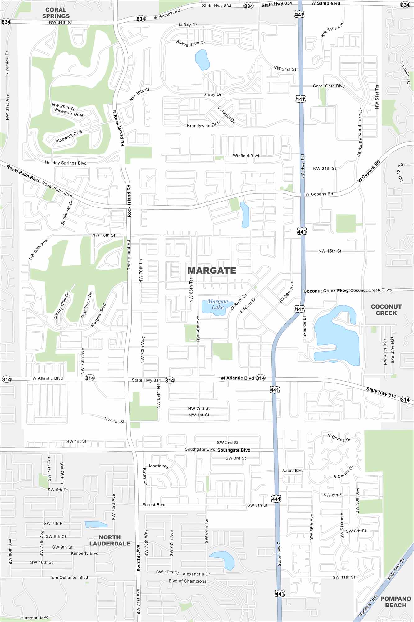
Explore our map of Margate in Broward County, Florida. Highways cut across neighborhoods, with canals and lakes scattered throughout. It lies inland from Pompano Beach and Fort Lauderdale.
Florida State Maps
Discover Florida through our state maps


Map Information
On the Map
Interstates/Highways: Florida’s Tpke, US Hwy 441, State Rd 7, State Hwy 834, State Hwy 814 Major Roads: Sample Rd, Atlantic Blvd, Rock Island Rd, Coconut Creek Pkwy, Copans Rd, Royal Palm Blvd, Winfield Blvd, Southgate Blvd, Banks Rd, Coral Lake Dr, NW 31st St, NW 80th Ave, NW 76th Ave, NW 66th Ave, NW 15th St, SW 81st Ave Lakes and Reservoirs: Margate Lake Nearby Communities: Coral Springs, Coconut Creek, North Lauderdale, Pompano BeachFlorida City Maps
Chart your course through Miami and Florida’s cities


