Map of Maricopa, Arizona
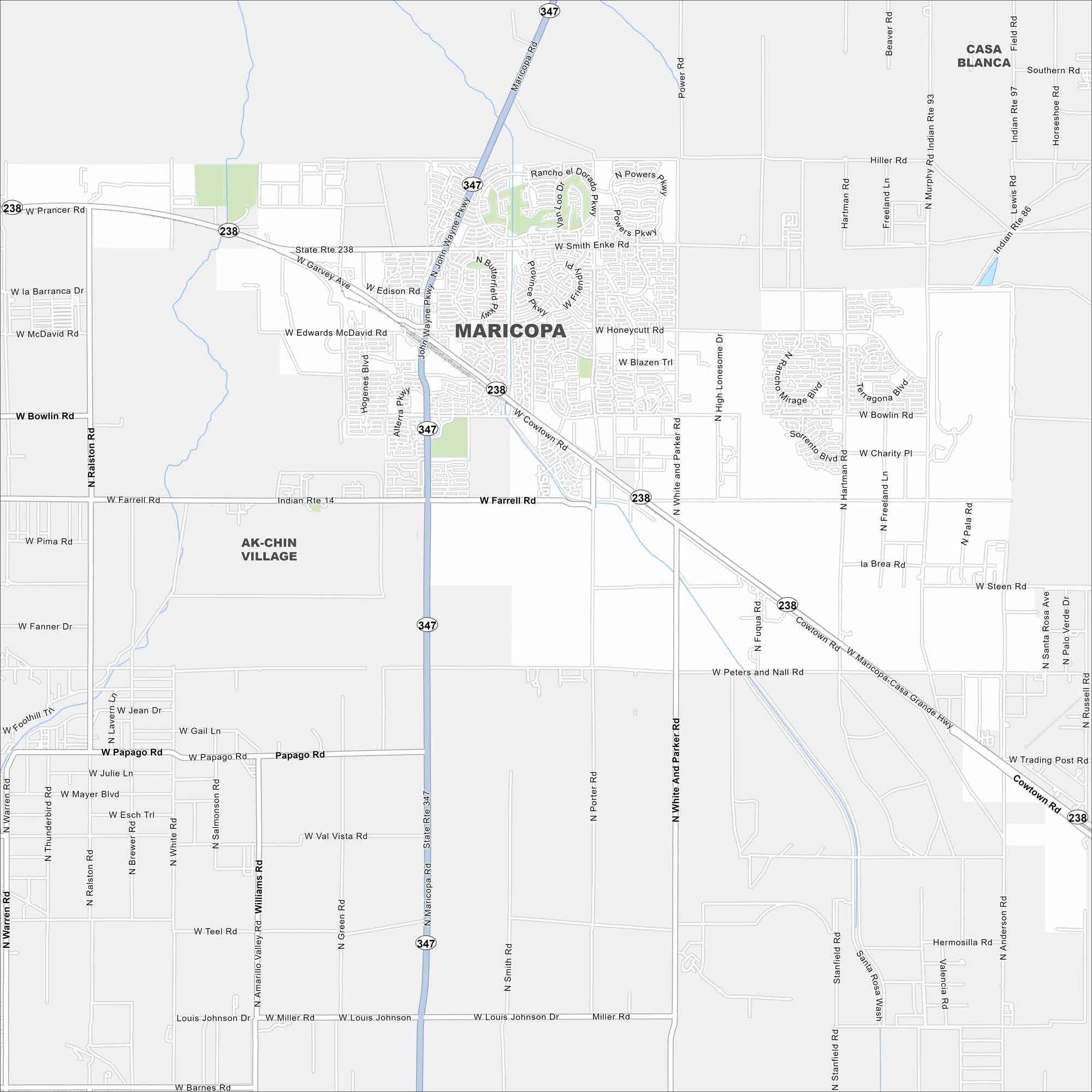
Maricopa sits in the Sonoran Desert south of Phoenix. Our map outlines its planned neighborhoods, highways, and open desert land. Rail lines also pass directly through the city.
Arizona State Maps
Check out our Arizona state maps we’ve put together


Map Information
On the Map
Interstates/Highways: State Route 347 (Maricopa Rd), State Route 238 (Maricopa-Casa Grande Hwy) Major Roads: Smith-Enke Rd, Honeycutt Rd, Farrell Rd, Bowlin Rd, Porter Rd, White and Parker Rd, Anderson Rd, Murphy Rd, Ralston Rd, Hidden Valley Rd, Peters and Nall Rd, Papago Rd, Green Rd, Warren Rd, Hartman Rd, Miller Rd, McDavid Rd, Desert Greens Dr, Continental Blvd Nearby Communities: Ak-Chin Indian CommunityArizona City Maps
Here’s our full batch of Arizona city maps


