Map of Marquette, Michigan
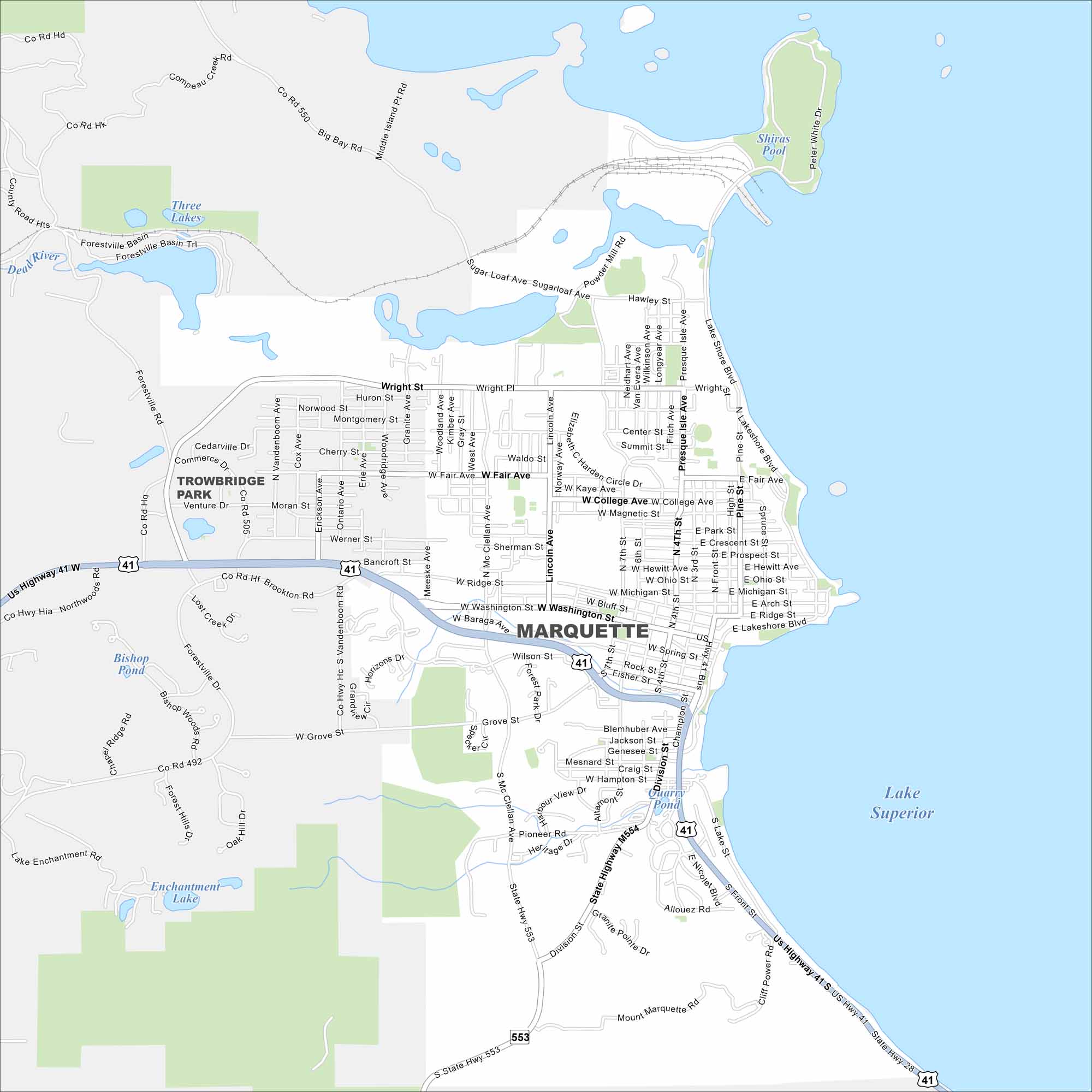
Our map of Marquette shows its shoreline on Lake Superior. The city’s streets rise into hills behind the waterfront. Highways run inland toward the Upper Peninsula.
Map Information
On the Map
Interstates/Highways: US Hwy 41, State Rte 28, State Highway M554, State Hwy 553 Major Roads: Washington St, Wright St, Front St, Lakeshore Blvd, Fair Ave, College Ave, Magnetic St, Hewitt Ave, Ridge St, Baraga Ave, Genesee St, Pioneer Rd, Division St, Presque Isle Ave, Hawley St, Sugar Loaf Ave, Center St, Fourth St, Third St, McClellan Ave Lakes and Reservoirs: Lake Superior, Shiras Pool, Three Lakes, Forestville Basin, Bishop Pond, Lake Enchantment, Enchantment Lake, Quarry Pond Major Rivers: Dead River Nearby Communities: Trowbridge ParkMichigan State Maps
Get to know Michigan with our detailed maps


City Maps of Michigan
Check out our maps of Detroit and other cities in Michigan


