Map of Winter Park, Florida
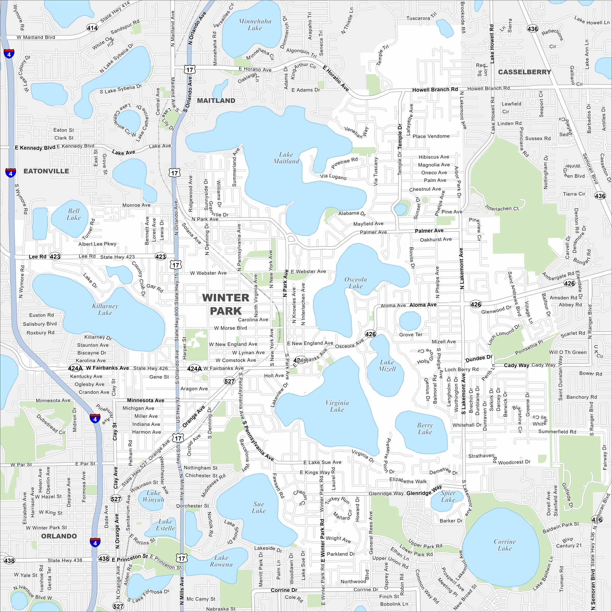
Our map displays the City of Winter Park, Florida. The city is known for brick-lined streets and its incredible arts scene. It’s also home to Rollins College.
Florida State Maps
Discover Florida through our state maps


Map Information
On the Map
Interstates/Highways: I-4, US Hwy 17, US Hwy 92, State Rte 436, State Rte 426, State Rte 423, State Rte 414, State Rte 527, State Rte 438 Major Roads: Fairbanks Ave, Aloma Ave, Orange Ave, Lee Rd, Webster Ave, Morse Blvd, New England Ave, Pennsylvania Ave, Park Ave, Lakemont Ave, Semoran Blvd, Maitland Blvd, Howell Branch Rd, Minnesota Ave, Princeton St, Mills Ave, Denning Dr, New York Ave, Interlachen Ave, Glenridge Way Lakes and Reservoirs: Lake Maitland, Lake Virginia, Lake Osceola, Lake Mizell, Berry Lake, Lake Sue, Lake Howell, Lake Sybelia, Minnehaha Lake, Lake Killarney, Lake Winyah, Lake Estelle, Lake Rowena, Bell Lake, Lake Catherine, Lily Lake, Spier Lake, Corrine Lake, Baldwin Lake, Skeleton Lake Nearby Communities: Orlando, Eatonville, Maitland, CasselberryFlorida City Maps
Chart your course through Miami and Florida’s cities


