Map of Melbourne, Florida
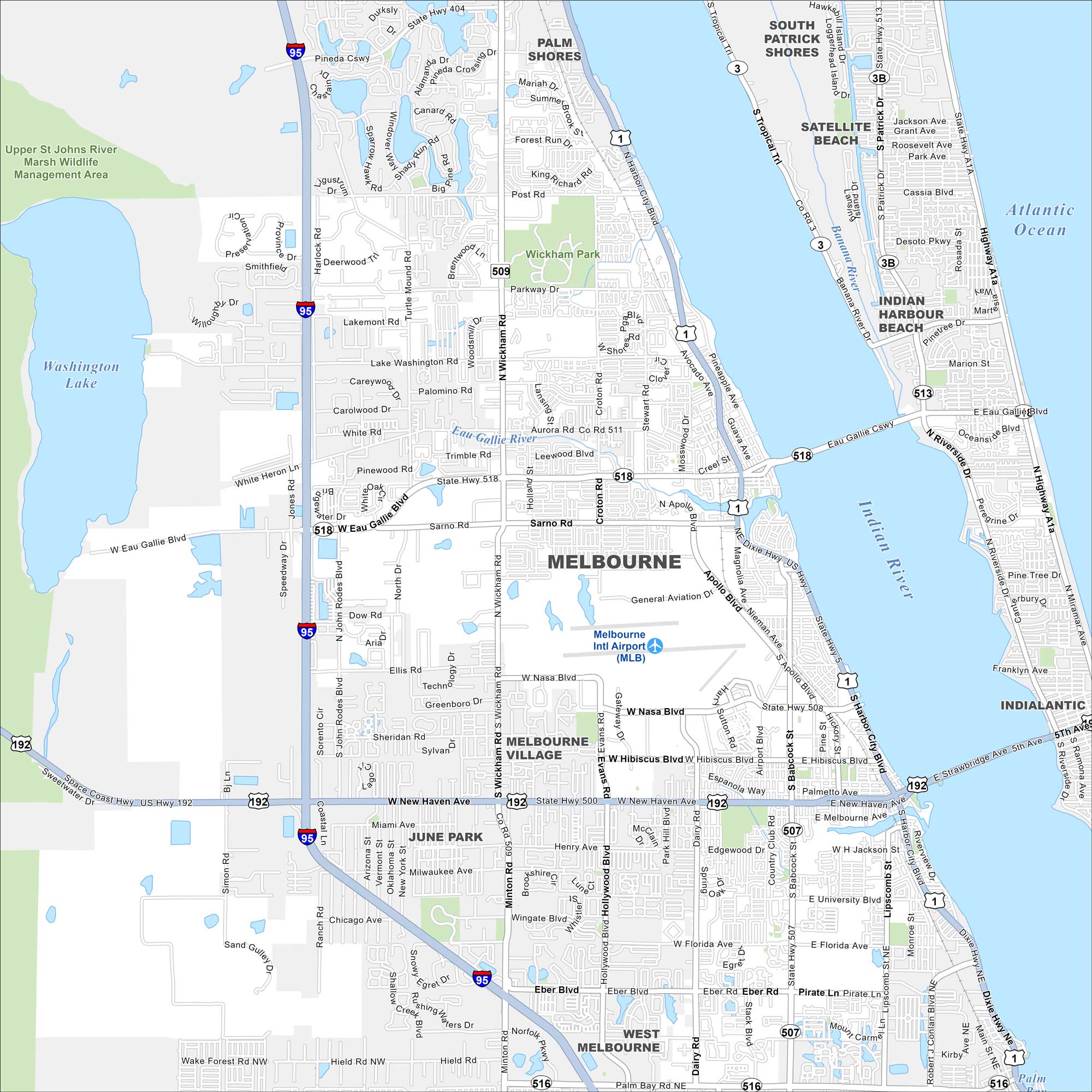
Melbourne lies along the Indian River Lagoon near the Atlantic coast. Our map highlights the causeways, downtown, and nearby beaches. It’s also really close to Cape Canaveral.
Florida State Maps
Discover Florida through our state maps


Map Information
On the Map
Interstates/Highways: I-95, US Hwy 1, US Hwy 192, State Rte 518, State Rte 509, State Rte 404, State Rte 511, State Rte 516, State Rte 513 Major Roads: Wickham Rd, Eau Gallie Blvd, New Haven Ave, NASA Blvd, Sarno Rd, Minton Rd, Apollo Blvd, Dairy Rd, Hollywood Blvd, Eber Blvd, Babcock St, Harbor City Blvd, Post Rd, Lake Washington Rd, Aurora Rd, Turtle Mound Rd, Harlock Rd, Croton Rd, Parkway Dr, Bennett Ln Airports: Melbourne Intl Airport (MLB) Lakes and Reservoirs: Washington Lake, Atlantic Ocean Major Rivers: Banana River, Indian River, Eau Gallie River Parks and Preserves: Upper St Johns River Marsh Wildlife Management Area, Wickham Park Nearby Communities: Palm Shores, Melbourne Village, June Park, West Melbourne, South Patrick Shores, Satellite Beach, Indian Harbour Beach, IndialanticFlorida City Maps
Chart your course through Miami and Florida’s cities


