Map of Winter Springs, Florida
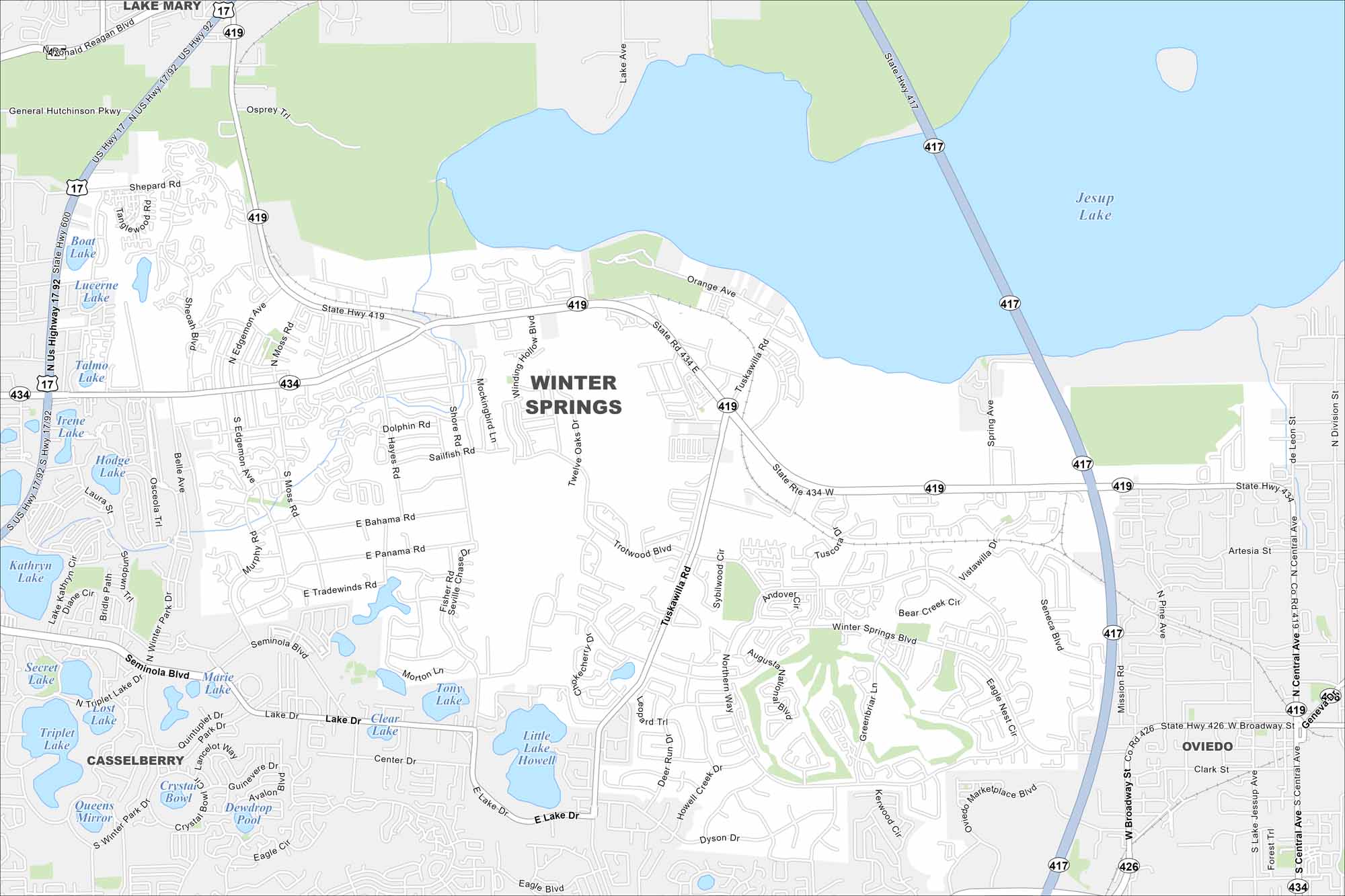
Our road map of Winter Springs highlights its neighborhoods and parks. It’s a growing community northeast of Orlando, Florida.
Florida State Maps
Discover Florida through our state maps


Map Information
On the Map
Interstates/Highways: State Rte 417, US Hwy 17, US Hwy 92, State Rte 434, State Rte 419, State Rte 426 Major Roads: Tuskawilla Rd, Seminole Blvd, Winter Springs Blvd, Central Ave, Moss Rd, Edgemon Ave, Hayes Rd, Shore Rd, Northern Way, Greenbriar Ln, Vista-Willa Dr, Spring Ave, Mission Rd, Broadway St, Lake Dr, Vistawilla Dr, Eagle Blvd, Keewin Cir, Dolphin Rd, Sailfish Rd Lakes and Reservoirs: Jesup Lake, Lake Howell, Little Lake Howell, Tony Lake, Clear Lake, Marie Lake, Triplet Lake, Lost Lake, Secret Lake, Kathryn Lake, Hodge Lake, Irene Lake, Talmo Lake, Lucerne Lake, Boat Lake, Sun Lake Nearby Communities: Casselberry, Oviedo, Lake MaryFlorida City Maps
Chart your course through Miami and Florida’s cities


