Map of Miami Beach, Florida
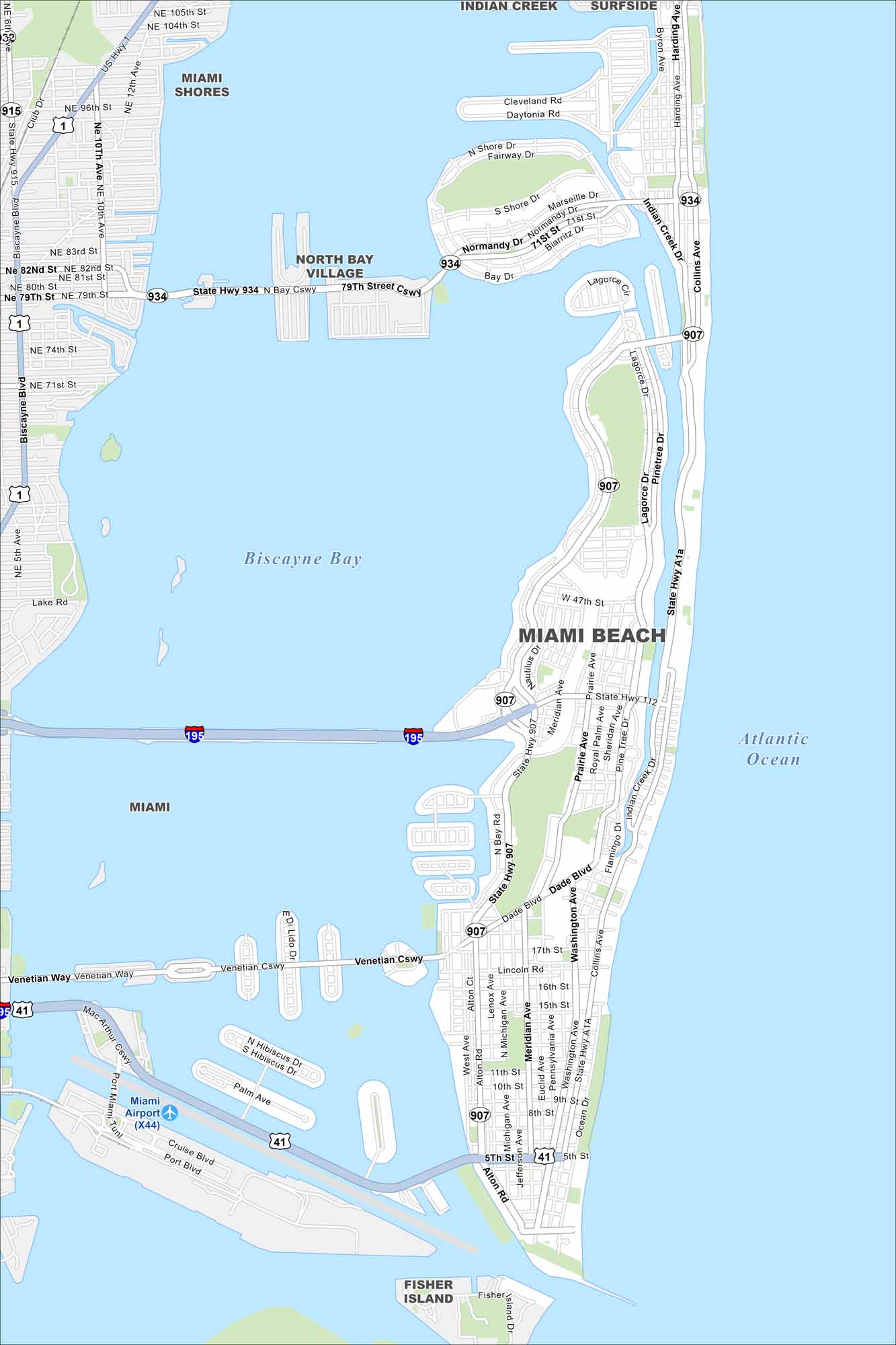
Miami Beach stretches along a barrier island. Our map shows its famous beachfront and causeways connecting to Miami. It’s tourism that mostly drives the city.
Florida State Maps
Discover Florida through our state maps


Map Information
On the Map
Interstates/Highways: I-195, US Hwy 1, US Hwy 41, State Rte 934, State Rte 907, State Rte 112, State Hwy A1A Major Roads: Collins Ave, Alton Rd, Washington Ave, Dade Blvd, Venetian Cswy, MacArthur Cswy, Pine Tree Dr, Meridian Ave, Michigan Ave, Jefferson Ave, Pennsylvania Ave, Euclid Ave, 71st St, 79th Street Cswy, Normandy Dr, Biarritz Dr, Marseille Dr, 17th St, 11th St, 5th St Airports: Miami Airport (X44) Lakes and Reservoirs: Biscayne Bay, Atlantic Ocean Nearby Communities: Miami, Miami Shores, North Bay Village, Surfside, Fisher IslandFlorida City Maps
Chart your course through Miami and Florida’s cities


