Map of Miami Gardens, Florida
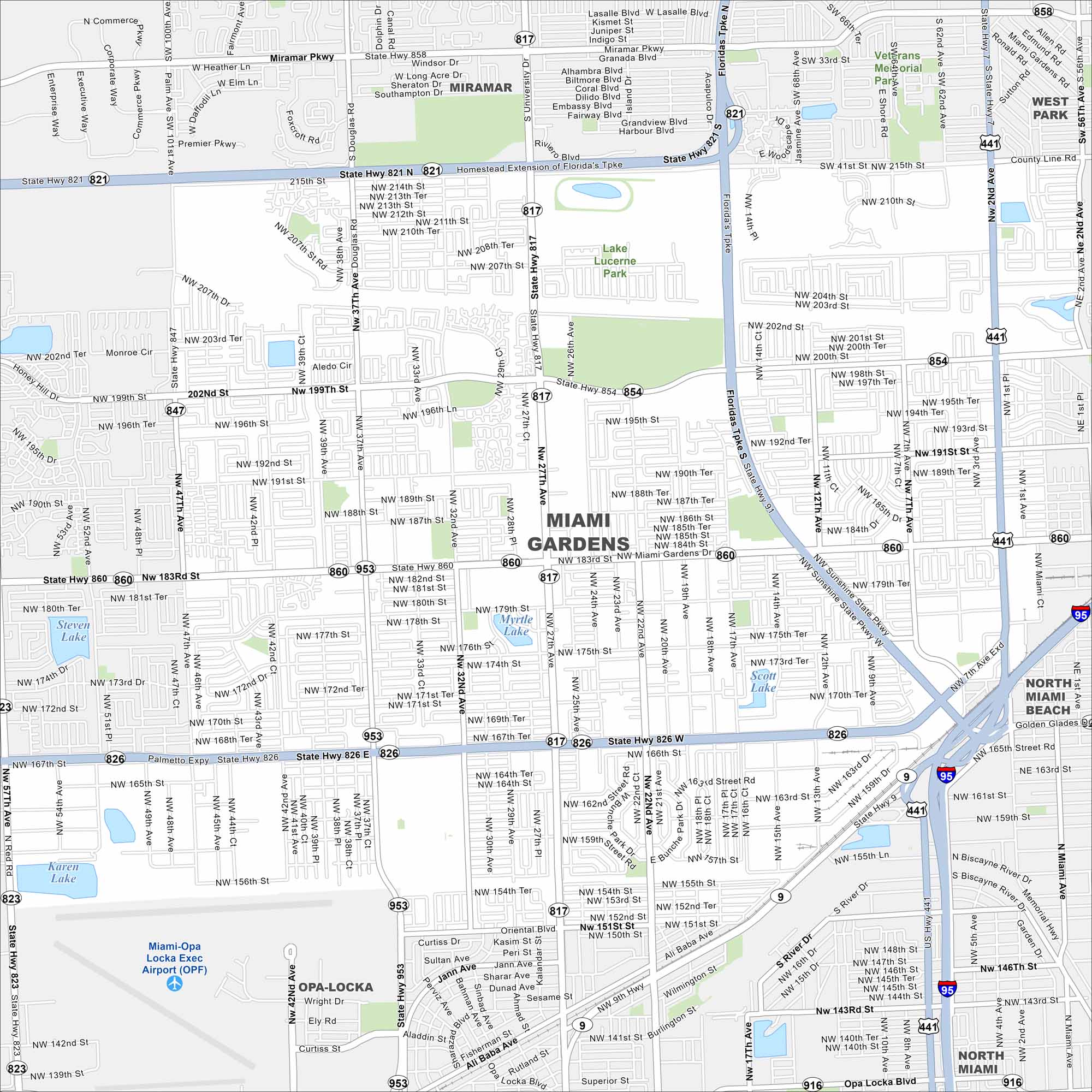
Our map of Miami Gardens highlights its residential neighborhoods and highways. The city sits north of central Miami with Hard Rock Stadium as a major landmark.
Florida State Maps
Discover Florida through our state maps


Map Information
On the Map
Interstates/Highways: I-95, US Hwy 441, State Rte 826, State Rte 821, State Rte 9, State Rte 817, State Rte 860, State Rte 854, State Rte 823, State Rte 847, State Rte 953 Major Roads: Miami Gardens Dr, NW 183rd St, NW 27th Ave, Miramar Pkwy, NW 37th Ave, Palmetto Expy, NW 199th St, NW 167th St, NW 7th Ave, NW 12th Ave, NW 57th Ave, Honey Hill Rd, NW 175th St Airports: Miami-Opa Locka Exec Airport (OPF) Lakes and Reservoirs: Scott Lake, Myrtle Lake, Steven Lake, Karen Lake Parks and Preserves: Lake Lucerne Park, Veterans Memorial Park Nearby Communities: Miramar, Opa-Locka, North Miami Beach, West Park, Lake LucerneFlorida City Maps
Chart your course through Miami and Florida’s cities


