Map of Miami Shores, Florida
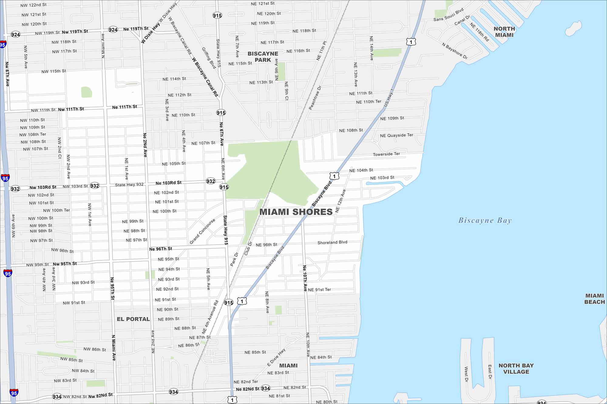
Our map of Miami Shores highlights this city that sits along Biscayne Bay just north of Miami. Picture tree-lined streets and quiet neighborhoods. Parks and schools give it a strong community feel.
Florida State Maps
Discover Florida through our state maps


Map Information
On the Map
Interstates/Highways: I-95, US Hwy 1, State Rte 915, State Rte 932, State Rte 934, State Rte 924 Major Roads: Biscayne Blvd, NE 6th Ave, NE 103rd St, NE 2nd Ave, N Miami Ave, NW 103rd St, W Biscayne Canal Rd, Shoreland Blvd, NE 12th Ave, NE 10th Ave, Grand Concourse, Park Dr, NE 96th St, NW 95th St Lakes and Reservoirs: Biscayne Bay Nearby Communities: North Miami, Biscayne Park, El Portal, Miami, North Bay Village, Miami BeachFlorida City Maps
Chart your course through Miami and Florida’s cities


