Map of Miami Springs, Florida
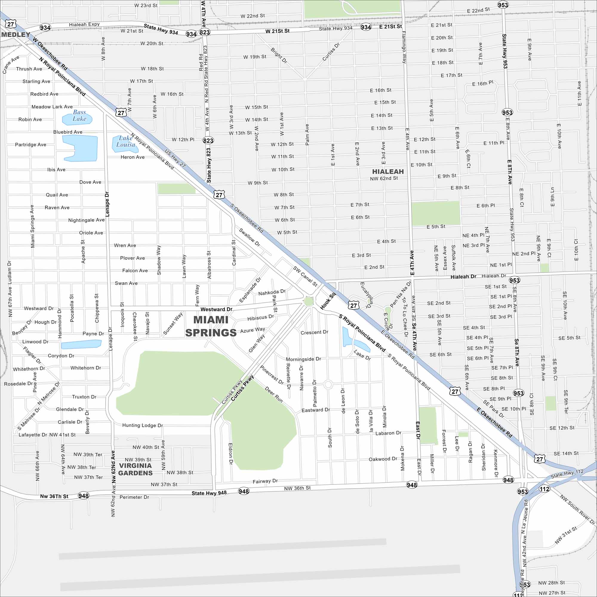
Learn about Miami Springs with our road map. The city’s circular street plan stands out immediately with the airport to the south. It’s one of the area’s original planned communities.
Florida State Maps
Discover Florida through our state maps


Map Information
On the Map
Interstates/Highways: US Hwy 27, State Rte 934, State Rte 953, State Rte 948, State Rte 112, State Rte 823 Major Roads: NW 36th St, Okeechobee Rd, S Royal Poinciana Blvd, NW 42nd Ave, Le Jeune Rd, Curtiss Pkwy, Westward Dr, NW 12th St, NW 62nd Ave, Ludlam Dr, East Dr, Eldron Dr, Hook Sq, Deer Run, Fairway Dr, Morningside Dr, Nightingale Ave, Kenmore Dr Lakes and Reservoirs: Lake Louisa, Bass Lake Nearby Communities: Hialeah, Medley, Virginia GardensFlorida City Maps
Chart your course through Miami and Florida’s cities


