Map of Mount Dora, Florida
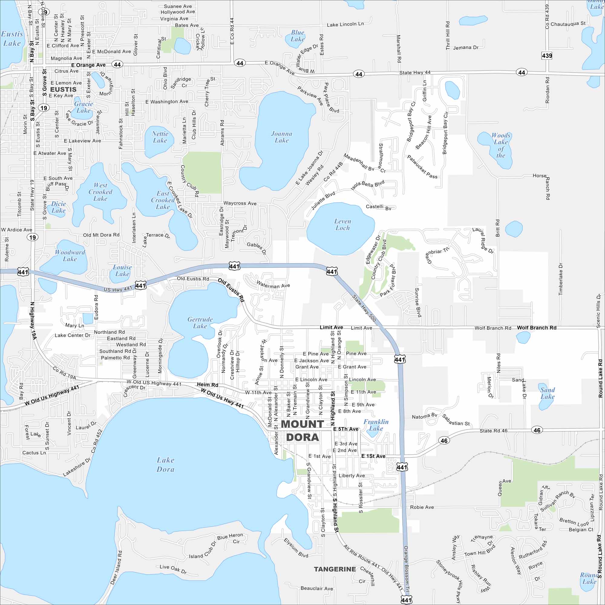
Check out Mount Dora on our map of central Florida. Lake Dora borders the city, with historic downtown streets nearby. Festivals and waterfront views make it a regional draw.
Florida State Maps
Discover Florida through our state maps


Map Information
On the Map
Interstates/Highways: US Hwy 441, State Rte 19, State Rte 44, State Rte 46, State Rte 500 Major Roads: Old US Highway 441, Highland St, Orange Ave, Donnelly St, Clayton St, Limit Ave, 5th Ave, 1st Ave, Eudora Rd, Lincoln Ave, Heim Rd, Lakeshore Dr, Wolf Branch Rd, Round Lake Rd, Simpson St Lakes and Reservoirs: Lake Dora, Lake Eustis, Gertrude Lake, Joanna Lake, Blue Lake, Louise Lake, Woodward Lake, West Crooked Lake, East Crooked Lake, Nettie Lake, Gracie Lake, Leven Loch, Franklin Lake, Sand Lake, Round Lake Nearby Communities: Eustis, TangerineFlorida City Maps
Chart your course through Miami and Florida’s cities


