Map of Mount Holly, North Carolina
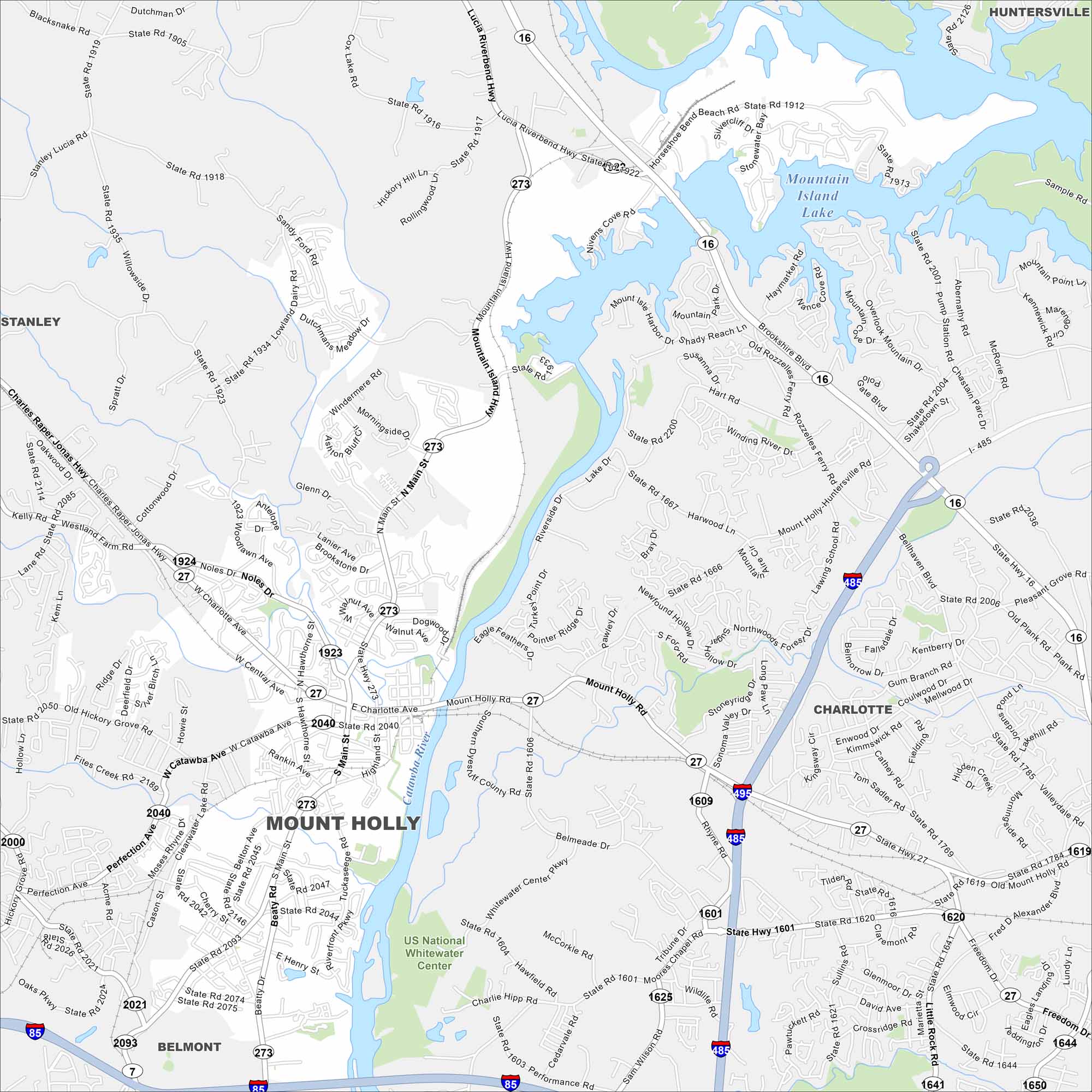
Our map of Mount Holly highlights its location along the Catawba River. It’s just west of Charlotte, with neighborhoods, parks, and mills tied to its past. The riverfront is a defining feature.
Map Information
On the Map
Interstates/Highways: I-485, US Hwy 29, State Rte 16, State Rte 27, State Rte 85, State Rte 273 Major Roads: Mount Holly Rd, Charlotte Ave, Central Ave, Main St, Tuckaseegee Rd, Beatty Rd, Belmead Dr, Performance Rd, Lucia Riverbend Hwy, Mountain Island Hwy, Rozzelles Ferry Rd, Horseshoe Bend Beach Rd, Stonewall St, Rhyne Rd, Moores Chapel Rd, Little Rock Rd, Toddville Rd, Freedom Dr, Paw Creek Rd, Gum Branch Rd Lakes and Reservoirs: Mountain Island Lake Major Rivers: Catawba River Parks and Preserves: US National Whitewater Center Nearby Communities: Stanley, Huntersville, Charlotte, BelmontNorth Carolina State Maps
Get to know the mountains and coastlines of North Carolina.


City Maps of North Carolina
Journey through North Carolina with our city maps


