Map of Naples, Florida
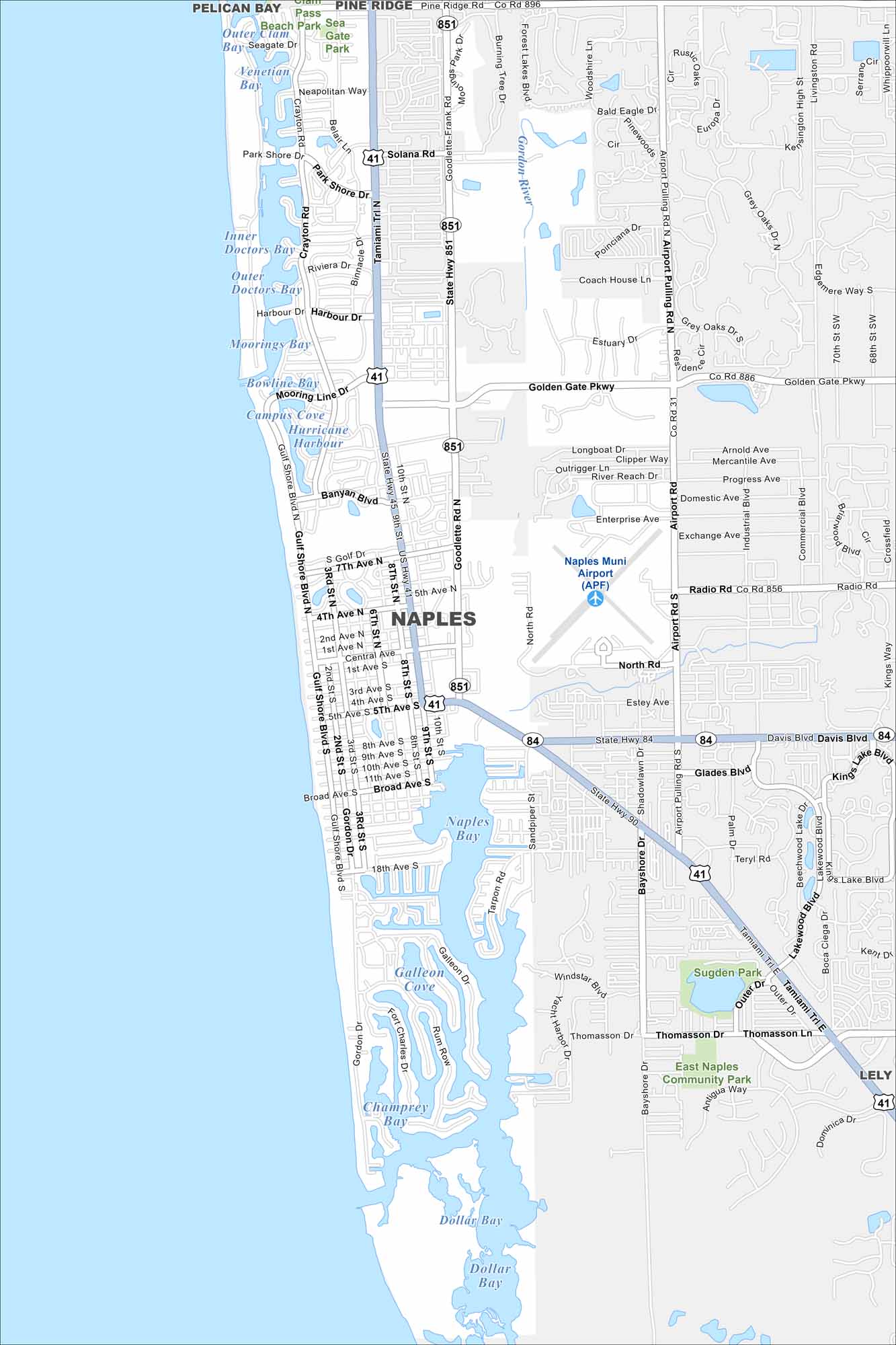
Get to know Naples by viewing our map of the Gulf Coast. The city features a grid of beachside neighborhoods, golf courses, and wetlands. Its coastline is known for white sand and calm waters.
Florida State Maps
Discover Florida through our state maps


Map Information
On the Map
Interstates/Highways: US Hwy 41, State Rte 851, State Rte 84 Major Roads: Golden Gate Pkwy, Airport Pulling Rd, Goodlette-Frank Rd, Tamiami Trl, Gulf Shore Blvd, 5th Ave, Central Ave, Broad Ave, Radio Rd, Davis Blvd, Solana Rd, Banyan Blvd, Mooring Line Dr, Harbour Dr, Park Shore Dr, North Rd, 9th St, 3rd St Airports: Naples Muni Airport (APF) Lakes and Reservoirs: Naples Bay, Dollar Bay, Moorings Bay, Venetian Bay, Inner Doctors Bay, Outer Doctors Bay, Hurricane Harbour, Champney Bay Major Rivers: Gordon River Parks and Preserves: Seagate Park, Sugden Park, East Naples Community Park Nearby Communities: Lely, Pelican BayFlorida City Maps
Chart your course through Miami and Florida’s cities


