Map of New Bern, North Carolina
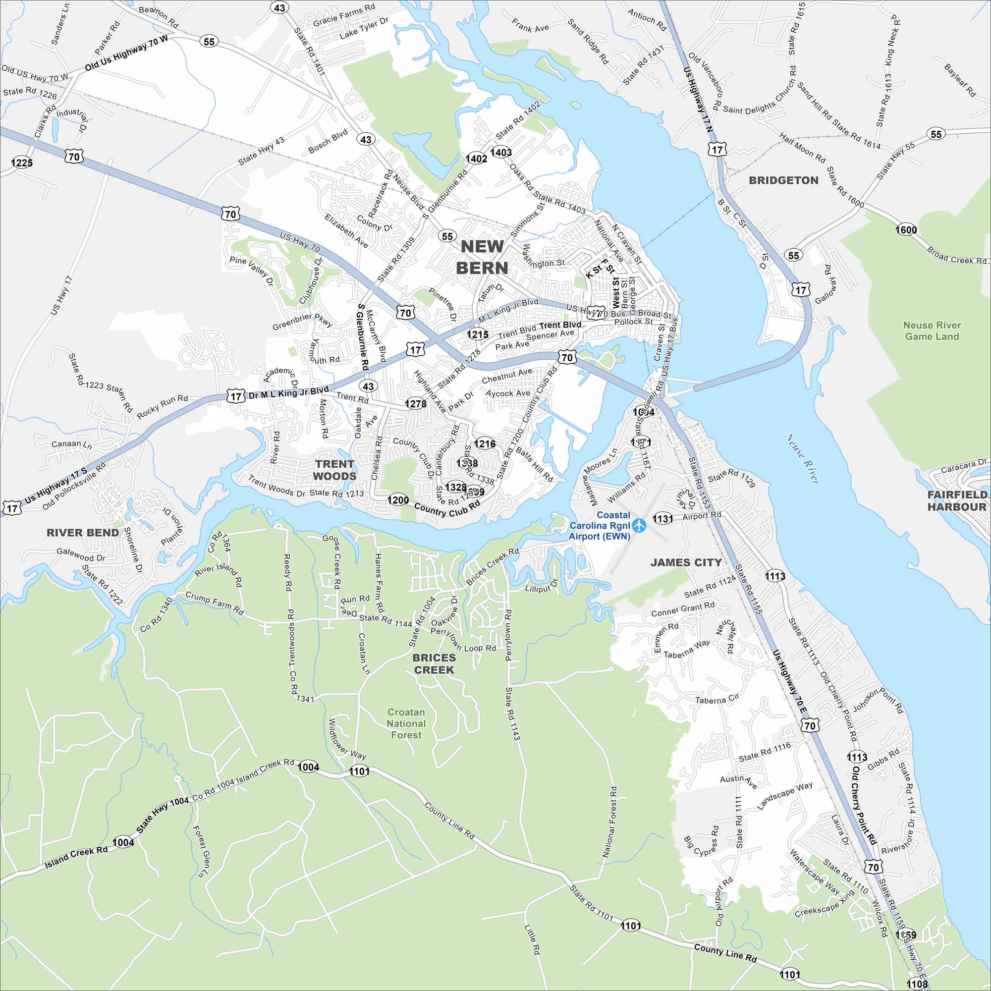
New Bern rests at the meeting of the Neuse and Trent Rivers. Our map shows its historic downtown, riverfront, and nearby neighborhoods. The city is known as the birthplace of Pepsi.
Map Information
On the Map
Interstates/Highways: US Hwy 17, US Hwy 70, State Rte 43, State Rte 55 Major Roads: ML King Jr Blvd, Trent Blvd, Country Club Rd, Glenburnie Rd, Neuse Blvd, Oaks Rd, Broad St, Pollock St, Front St, National Ave, Madame Moore Ln, Elizabeth Ave, Racetrack Rd, Old Cherry Point Rd, Island Creek Rd, County Line Rd, B St, C St, Washington St, Pembroke Rd Airports: Coastal Carolina Rgnl Airport (EWN) Major Rivers: Neuse River Parks and Preserves: Croatan National Forest, Neuse River Game Land Nearby Communities: Bridgeton, James City, Fairfield Harbour, Trent Woods, River BendNorth Carolina State Maps
Get to know the mountains and coastlines of North Carolina.


City Maps of North Carolina
Journey through North Carolina with our city maps


