Map of New Rochelle, New York
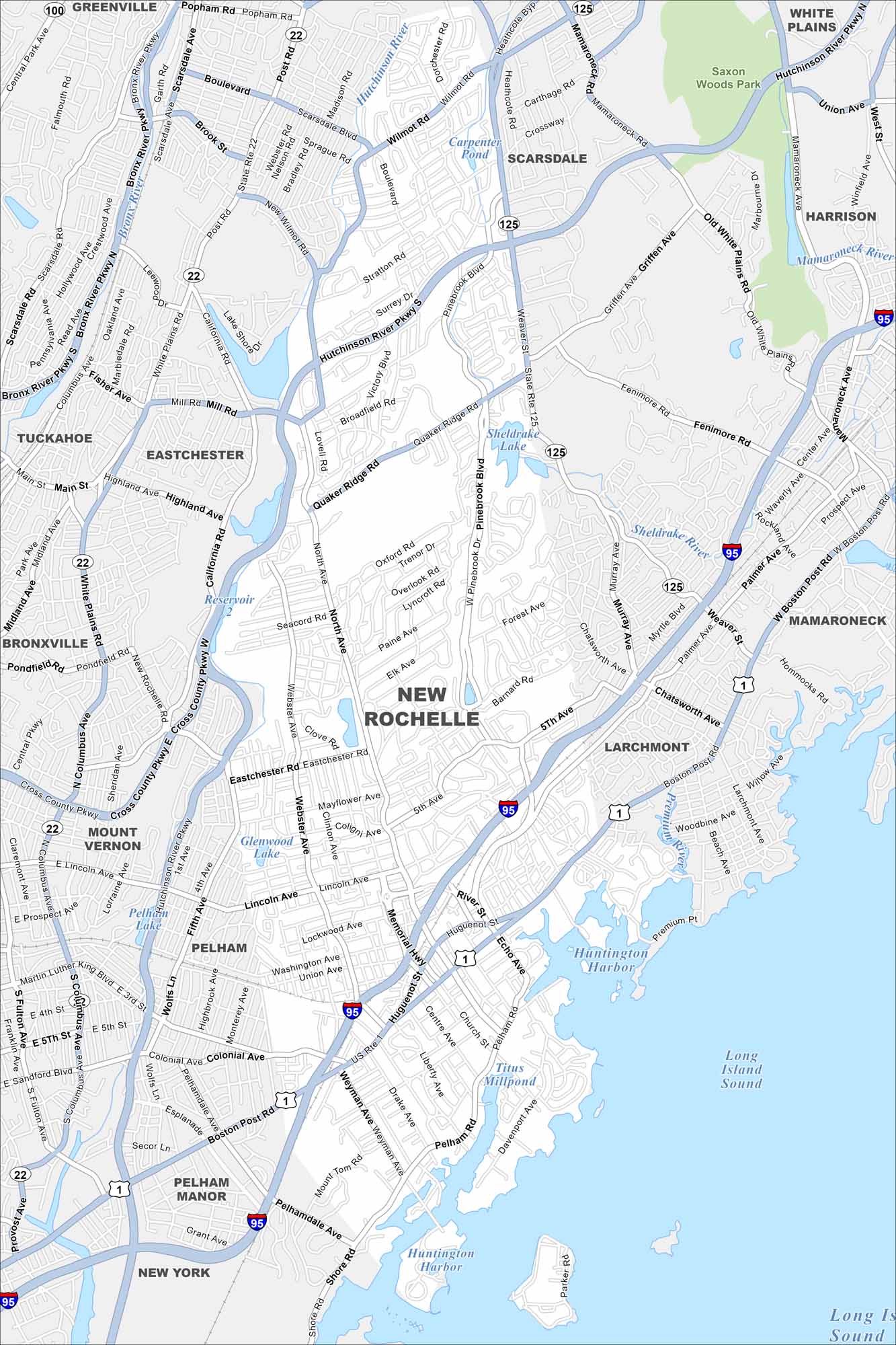
Our map of New Rochelle shows a city on the Long Island Sound. High-rises rise near the shoreline, while residential areas spread inland. It’s one of the largest cities in Westchester County.
Map Information
On the Map
Interstates/Highways: I-95, State Rte 22, State Rte 125, US Hwy 1 Major Roads: Hutchinson River Pkwy, Cross County Pkwy, Bronx River Pkwy, Main St, North Ave, Pelham Rd, Shore Rd, Weaver St, Palmer Ave, Quaker Ridge Rd, Pinebrook Blvd, Webster Ave, Lincoln Ave, 5th Ave, Huguenot St, Weyman Ave, Wilmot Rd, Stratton Rd, Broadfield Rd, Chatsworth Ave Lakes and Reservoirs: Long Island Sound, Sheldrake Lake, Glenwood Lake, Titus Millpond, Huntington Harbor, Premium Mill Pond Major Rivers: Bronx River, Sheldrake River, Mamaroneck River Parks and Preserves: Saxon Woods Park Nearby Communities: New Rochelle, Pelham, Pelham Manor, Mount Vernon, Bronxville, Tuckahoe, Eastchester, Scarsdale, Mamaroneck, LarchmontNew York State Maps
Find state maps of the Empire State.


City Maps of New York
Here are the city maps that define New York


