Map of Newburgh, New York
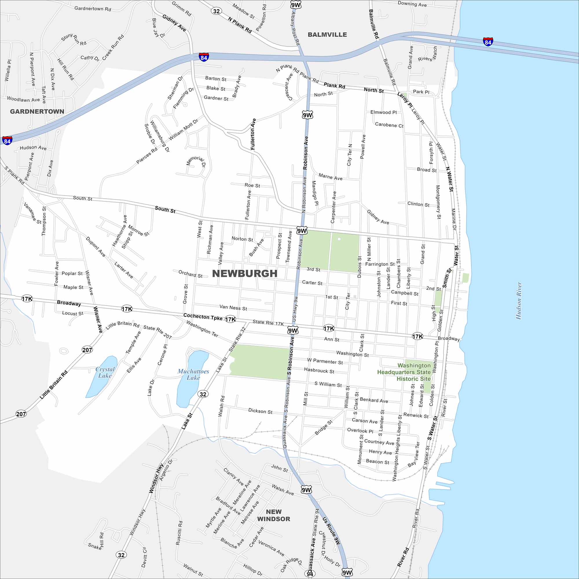
Newburgh overlooks the Hudson River about 60 miles north of New York City. Take a look at our map to see the riverfront and grid-like downtown. It sits next to the Hudson River on the east side.
Map Information
On the Map
Interstates/Highways: I-84, US Hwy 9W, State Rte 32, State Rte 17K, State Rte 207, US Route 9W Major Roads: Broadway, South St, Robinson Ave, Plank Rd, North St, Fullerton Ave, River Rd, Union Ave, Gidney Ave, Wisner Ave, Little Britain Rd, Windsor Hwy, Walsh Rd, Lake St, 1st St, 2nd St, 3rd St, South Ave, Marine Dr, Water St Lakes and Reservoirs: Muchattoes Lake, Crystal Lake Major Rivers: Hudson River Parks and Preserves: Washington Headquarters State Historic Site Nearby Communities: Balmville, Gardnertown, New WindsorNew York State Maps
Find state maps of the Empire State.


City Maps of New York
Here are the city maps that define New York


