Map of Niagara Falls, New York
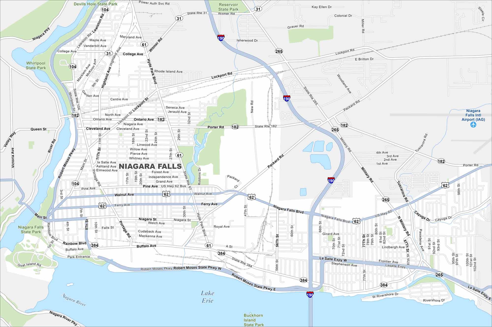
Niagara Falls sits on the Niagara River, opposite its Canadian twin. This map highlights the famous waterfalls, parks, and bridges across the border. Tourism shapes much of the layout here.
Map Information
On the Map
Interstates/Highways: I-190, US Hwy 62, US Hwy 62 Bus, State Rte 31, State Rte 104, State Rte 182, State Rte 265, State Rte 384 Major Roads: Niagara Falls Blvd, Military Rd, Pine Ave, Buffalo Ave, Main St, Ferry Ave, Walnut Ave, Packard Rd, Lockport Rd, Hyde Park Blvd, Lewiston Rd, Portage Rd, Witmer Rd, Ontario Ave, Cleveland Ave, Royal Ave, 56th St, 77th St, 81st St, 102nd St Airports: Niagara Falls Intl Airport Major Rivers: Niagara River Parks and Preserves: Niagara Falls State Park, Devils Hole State Park, Whirlpool State Park, Reservoir State Park, Buckhorn Island State ParkNew York State Maps
Find state maps of the Empire State.


City Maps of New York
Here are the city maps that define New York


