Map of North Port, Florida
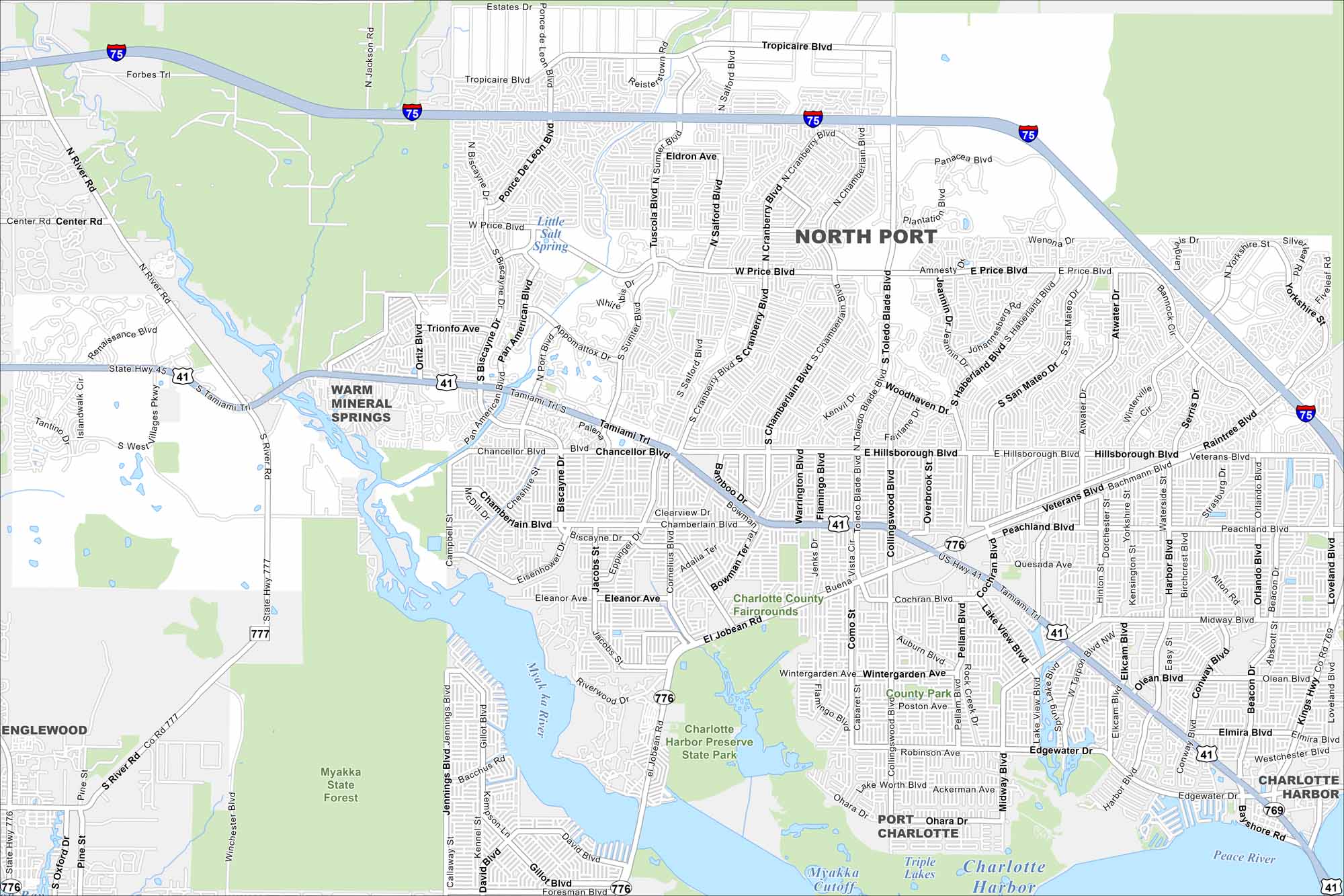
North Port lies between Sarasota and Port Charlotte. Check out this map to see its residential streets spread across pine flatwoods and waterways.
Florida State Maps
Discover Florida through our state maps


Map Information
On the Map
Interstates/Highways: I-75, US Hwy 41, State Hwy 776, State Hwy 777, State Hwy 769 Major Roads: Tamiami Trl, El Jobean Rd, Price Blvd, Hillsborough Blvd, Toledo Blade Blvd, Cranberry Blvd, Sumter Blvd, Ortiz Blvd, Biscayne Blvd, Chamberlain Blvd, San Mateo Dr, Yorkshire St, Salford Blvd, Tropicaire Blvd, River Rd, Chancellor Blvd, Eleanor Ave, Wintergarden Ave, Edgewater Dr, Veterans Blvd Lakes and Reservoirs: Charlotte Harbor, Little Salt Spring, Myakka Cutoff, Triple Lakes, Peace River Major Rivers: Myakka River Parks and Preserves: Myakka State Forest, Charlotte Harbor Preserve State Park Nearby Communities: Warm Mineral Springs, Englewood, Port Charlotte, Charlotte HarborFlorida City Maps
Chart your course through Miami and Florida’s cities


