Map of Novi, Michigan
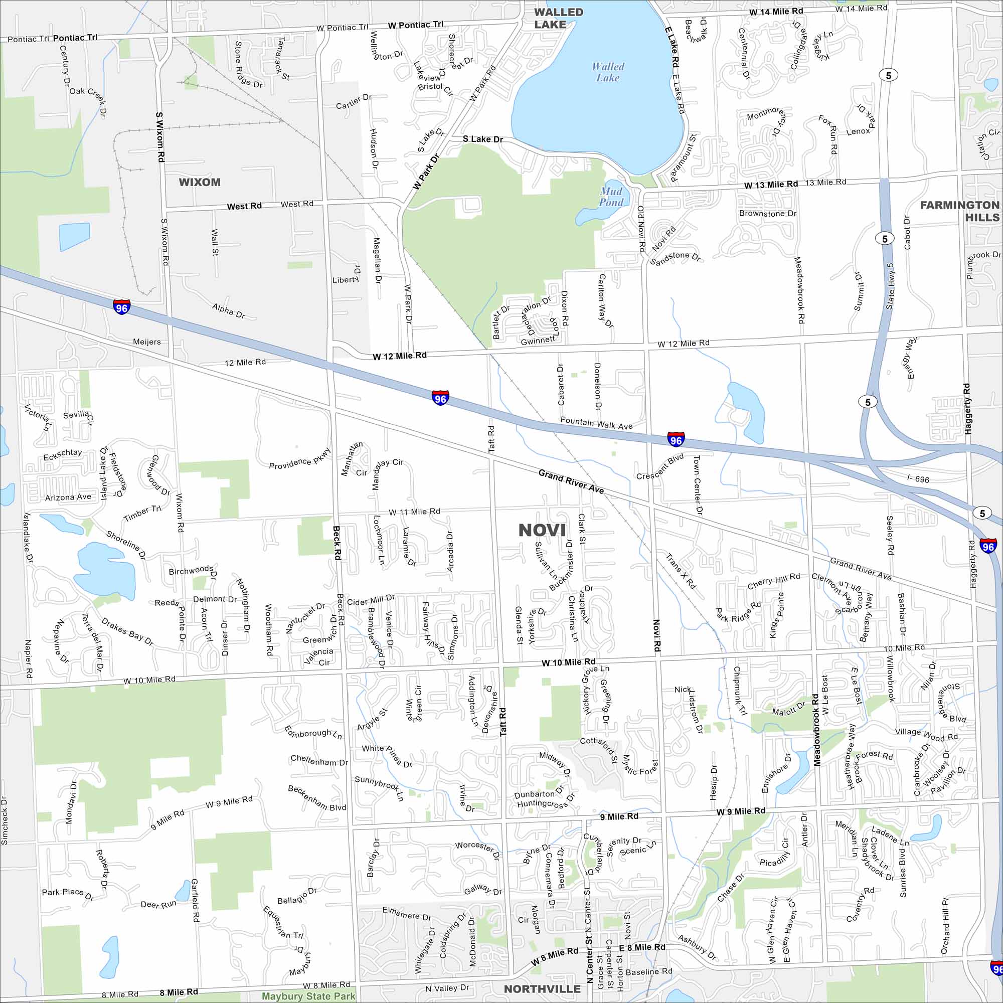
Novi lies northwest of Detroit in Oakland County. Our map highlights subdivisions, parks, and major highways. Over the years, it has become a key hub in the metro area.
Map Information
On the Map
Interstates/Highways: I-96, I-696, State Hwy 5 Major Roads: 14 Mile Rd, 13 Mile Rd, 12 Mile Rd, 11 Mile Rd, 10 Mile Rd, 9 Mile Rd, 8 Mile Rd, Novi Rd, Grand River Ave, Wixom Rd, Haggerty Rd, Beck Rd, Taft Rd, Meadowbrook Rd, Pontiac Trl, Walled Lake, South Lake Dr, West Rd, Alpha Dr, Ten Mile Rd Lakes and Reservoirs: Walled Lake, Mud Pond Parks and Preserves: Maybury State Park Nearby Communities: Wixom, Walled Lake, Farmington Hills, NorthvilleMichigan State Maps
Get to know Michigan with our detailed maps


City Maps of Michigan
Check out our maps of Detroit and other cities in Michigan


