Map of Oakland Park, Florida
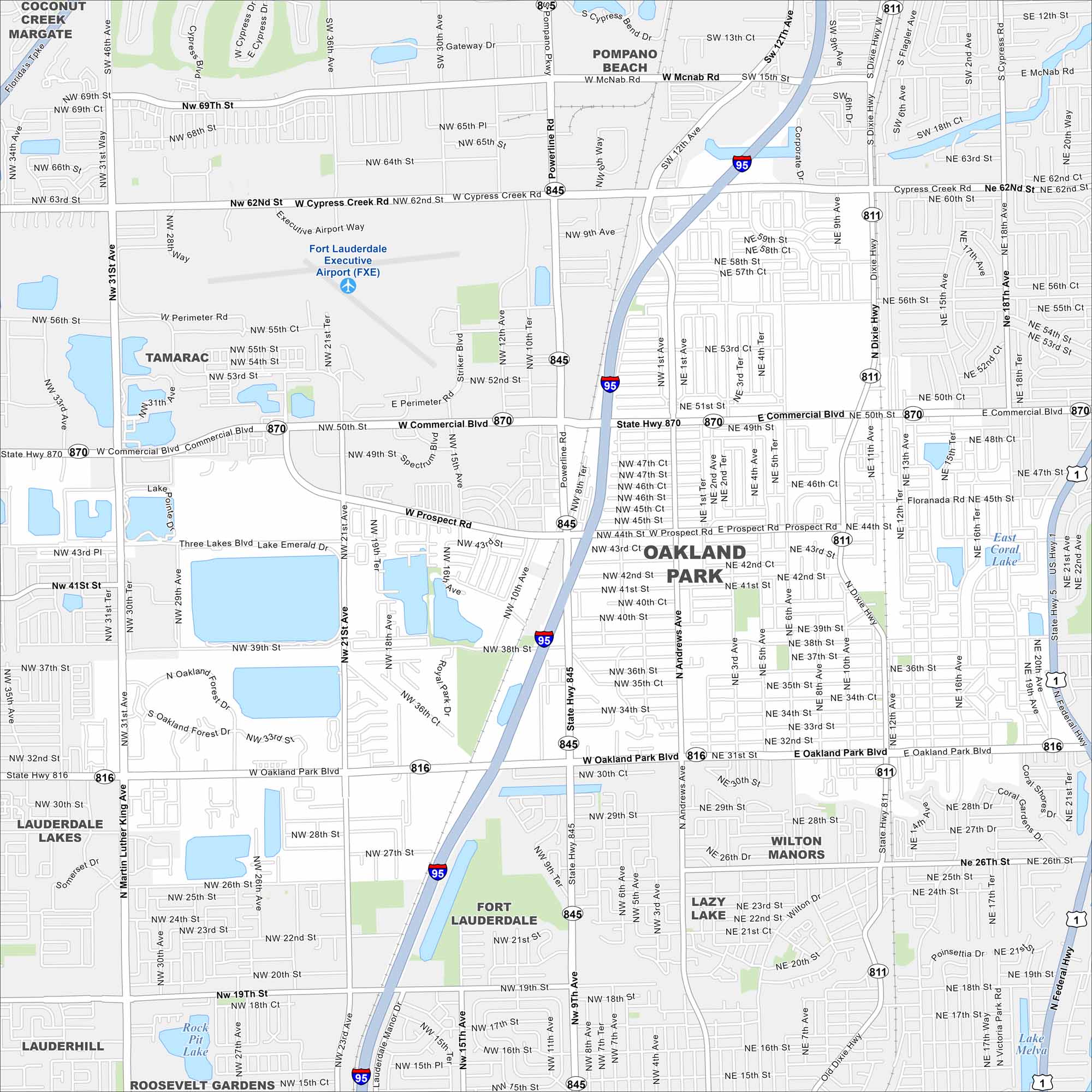
Oakland Park lies just north of Fort Lauderdale. Check out our map to see a compact urban grid with canals cutting through. It’s part of the larger South Florida metro area.
Florida State Maps
Discover Florida through our state maps


Map Information
On the Map
Interstates/Highways: I-95, US Hwy 1, State Hwy 870, State Hwy 816, State Hwy 845, State Hwy 811 Major Roads: Commercial Blvd, Oakland Park Blvd, Powerline Rd, Cypress Creek Rd, Andrews Ave, Dixie Hwy, Prospect Rd, 21st Ave, 31st Ave, 62nd St, 50th St, 38th St, 26th St, Federal Hwy, McNab Rd, Floranada Rd, 43rd St, 31st St, 12th Ave, 6th Ave Airports: Fort Lauderdale Executive Airport (FXE) Lakes and Reservoirs: Lake Emerald, East Coral Lake, Lake Melva Nearby Communities: Pompano Beach, Coconut Creek, Margate, Tamarac, Fort Lauderdale, Wilton Manors, Lazy Lake, Lauderdale Lakes, Lauderhill, Roosevelt GardensFlorida City Maps
Chart your course through Miami and Florida’s cities


