Map of Ocoee, Florida
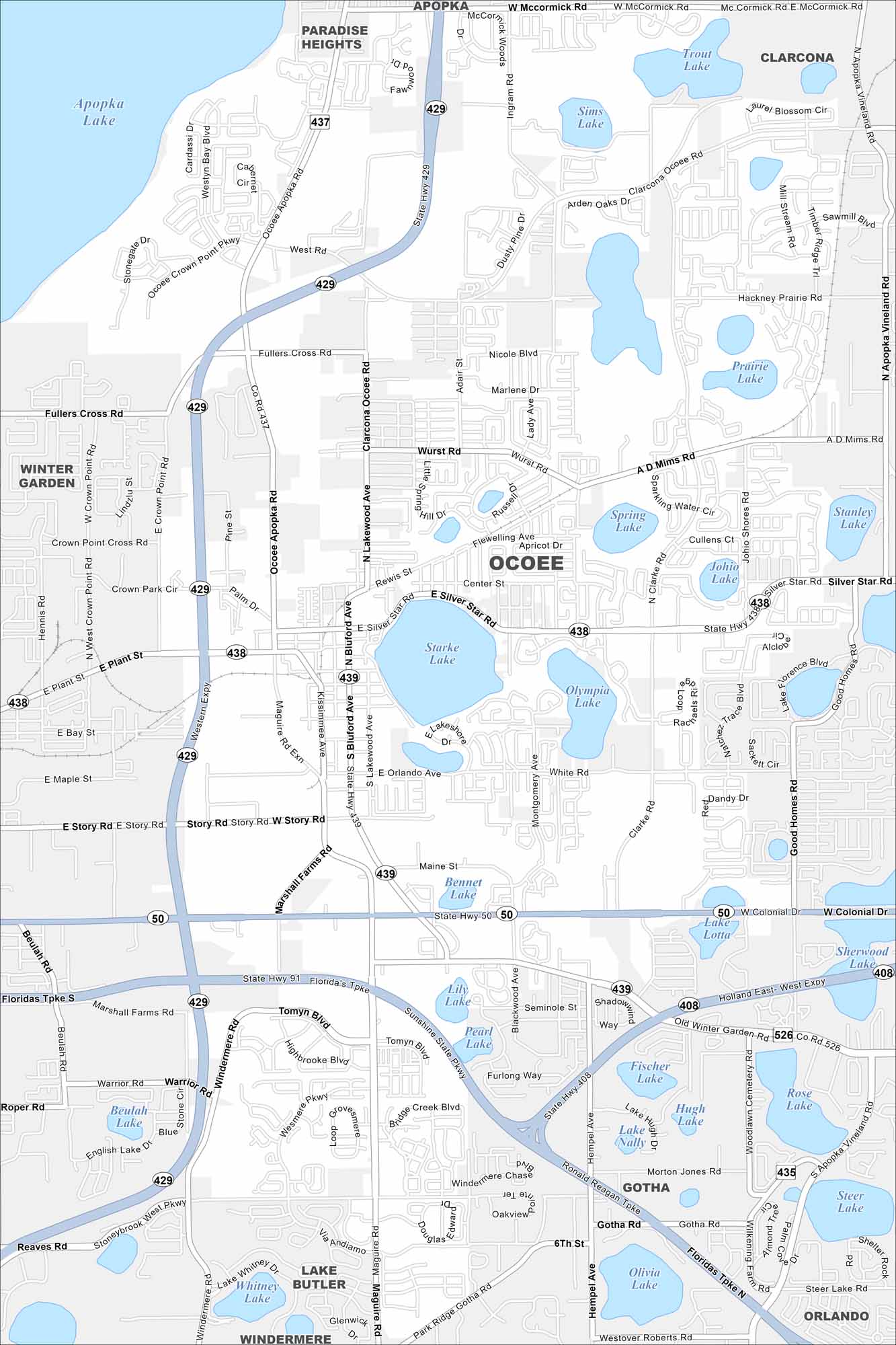
Ocoee lies west of Orlando with neighborhoods clustered around lakes. This map shows suburban developments linked by major highways. It has become a key part of the Orlando metro.
Florida State Maps
Discover Florida through our state maps


Map Information
On the Map
Interstates/Highways: State Hwy 429, Florida’s Tpke, State Hwy 50, State Hwy 438, State Hwy 439, State Hwy 408 Major Roads: Colonial Dr, Silver Star Rd, Clarke Rd, Maguire Rd, Bluford Ave, Ocoee Apopka Rd, Clarcona Ocoee Rd, Mc Mims Rd, Story Rd, Plant St, Crown Point Pkwy, Fullers Cross Rd, Maine St, West Rd, McCormick Rd, Lake Whitney Dr, Windermere Rd, Tomyn Blvd, Highbrooke Blvd, Warrior Rd Lakes and Reservoirs: Starke Lake, Olympia Lake, Apopka Lake, Sims Lake, Prairie Lake, Spring Lake, Johio Lake, Bennet Lake, Lake Lotta, Fischer Lake, Hugh Lake, Lake Nally, Pearl Lake, Lily Lake, Lake Whitney, Rose Lake, Steer Lake, Olivia Lake Nearby Communities: Apopka, Paradise Heights, Clarcona, Winter Garden, Gotha, Windermere, OrlandoFlorida City Maps
Chart your course through Miami and Florida’s cities


