Map of Palm Coast, Florida
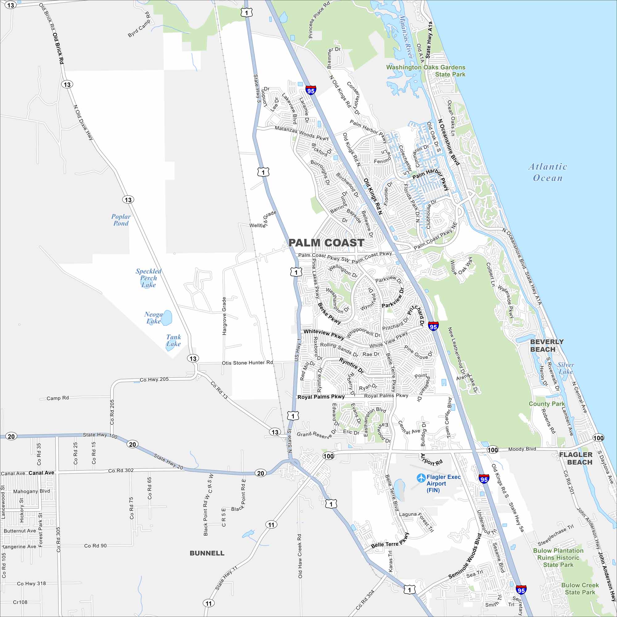
Palm Coast stretches between St. Augustine and Daytona Beach. Our map shows suburban neighborhoods set among canals and nature preserves. The Intracoastal Waterway runs right through the city.
Florida State Maps
Discover Florida through our state maps


Map Information
On the Map
Interstates/Highways: I-95, US Hwy 1, State Rte 11, State Rte 13, State Rte 20, State Rte 100 Major Roads: Palm Coast Pkwy, Belle Terre Pkwy, Old Kings Rd, Florida Park Dr, Palm Harbor Pkwy, Colbert Ln, Hammock Dunes Pkwy, Oceanshore Blvd, Pine Lakes Pkwy, Whiteview Pkwy, Royal Palms Pkwy, Cypress Point Pkwy, Seminole Woods Blvd, Sesame Blvd, Waterfront Park Rd, Otis Stone Hunter Rd, Hargrove Grade, Matanzas Woods Pkwy Airports: Flagler Exec Airport (FIN) Lakes and Reservoirs: Atlantic Ocean, Matanzas River, Poplar Pond, Speckled Perch Lake, Neoga Lake, Tank Lake, Silver Lake Major Rivers: Matanzas River Parks and Preserves: Washington Oaks Gardens State Park, Bulow Plantation Ruins Historic State Park, Bulow Creek State Park Nearby Communities: Beverly Beach, Flagler Beach, BunnellFlorida City Maps
Chart your course through Miami and Florida’s cities


