Map of Paradise Valley, Arizona
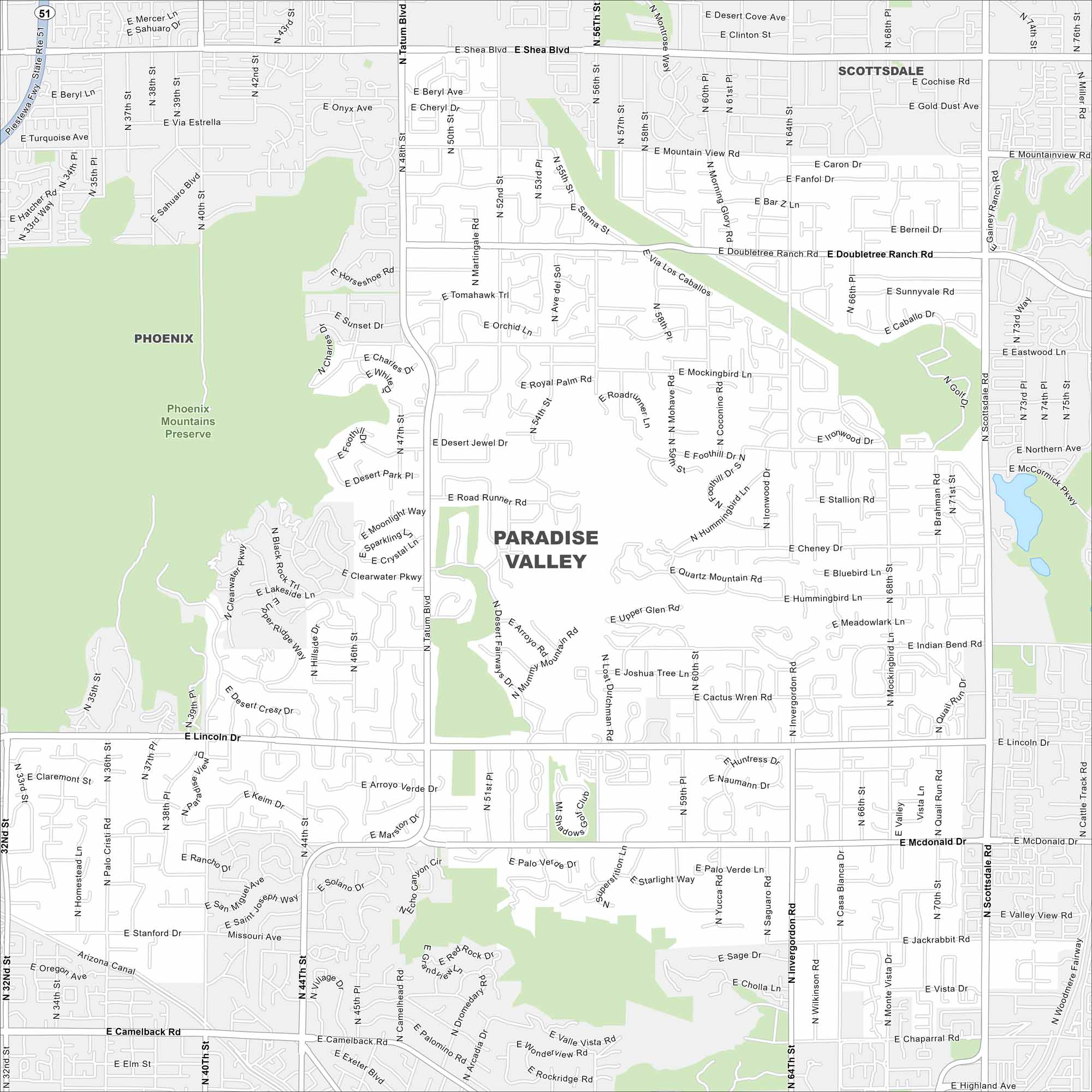
Paradise Valley is tucked between Phoenix and Scottsdale. Our map shows winding streets and desert hills. Camelback Mountain looms as the most recognizable landmark to the south.
Arizona State Maps
Check out our Arizona state maps we’ve put together


Map Information
On the Map
Interstates/Highways: Piestewa Fwy (State Rte 51) Major Roads: Scottsdale Rd, Tatum Blvd, Shea Blvd, Camelback Rd, Lincoln Dr, McDonald Dr, Invergordon Rd, Doubletree Ranch Rd, Mockingbird Ln, Cheney Dr, Stanford Dr, Indian Bend Rd, Jackrabbit Rd, Chaparral Rd, Mountain View Rd, Mockingbird Ln, Saguaro Rd, Quail Run Rd, Wilkinson Rd, Casa Blanca Dr. Parks/Preserves/Forests: Phoenix Mountains Preserve Nearby Communities: Phoenix, ScottsdaleArizona City Maps
Here’s our full batch of Arizona city maps


