Map of Ypsilanti, Michigan
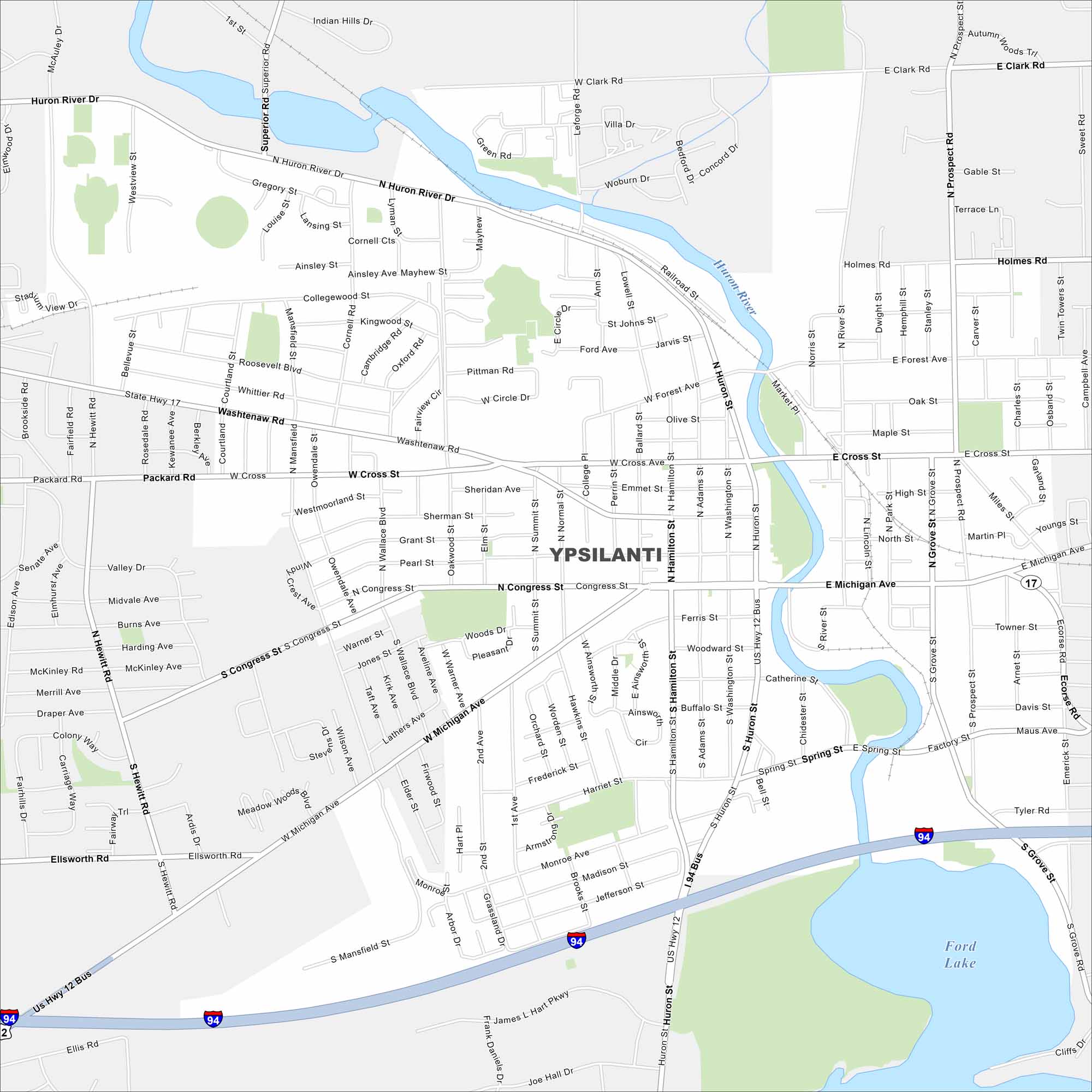
This Ypsilanti map shows the Huron River winding through town with Ford Lake in the southeast. Known as “Ypsi,” it blends history, arts, and university life.
Map Information
On the Map
Interstates/Highways: I-94, US Hwy 12, State Hwy 17 Major Roads: Michigan Ave, Washtenaw Ave, Huron St, Hamilton St, Congress St, Cross St, Packard Rd, Ellsworth Rd, Prospect Rd, Clark Rd, Forest Ave, Mansfield St, Hewitt Rd, Harris Rd, Ford Blvd, Ecorse Rd, Grove St, Holmes Rd, Whittaker Rd, Leforge Rd Lakes and Reservoirs: Ford Lake Major Rivers: Huron RiverMichigan State Maps
Get to know Michigan with our detailed maps


City Maps of Michigan
Check out our maps of Detroit and other cities in Michigan


