Map of Pembroke Pines, Florida
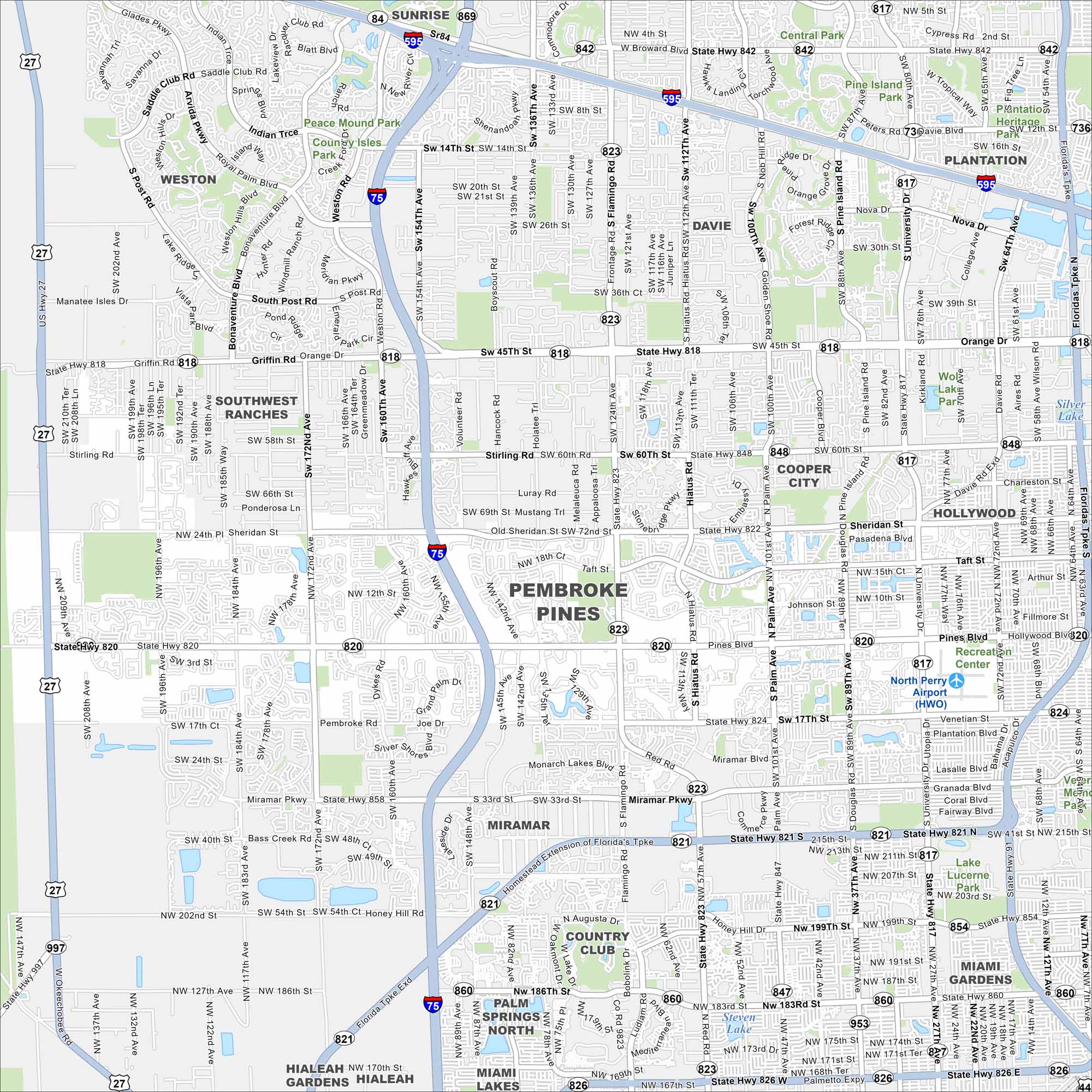
Our map of Pembroke Pines shows a city full of lakes and canals west of Hollywood. Suburban neighborhoods stretch across the grid. Parks and shopping centers are scattered throughout the area.
Florida State Maps
Discover Florida through our state maps


Map Information
On the Map
Interstates/Highways: I-75, US Hwy 27, US Hwy 441, State Rte 7, State Rte 817, State Rte 818, State Rte 820, State Rte 821, State Rte 822, State Rte 823, State Rte 824, State Rte 826, State Rte 84, State Rte 842, State Rte 847, State Rte 848, State Rte 854, State Rte 858, State Rte 860, State Rte 869 Major Roads: Pines Blvd, Sheridan St, Hollywood Blvd, Miramar Pkwy, Flamingo Rd, Palm Ave, Douglas Rd, University Dr, Hiatus Rd, Dykes Rd, Volunteer Rd, Johnson St, Taft St, Stirling Rd, Griffin Rd, Orange Dr, Bass Creek Rd, Honey Hill Rd, Mcnab Rd Airports: North Perry Airport (HWO) Lakes and Reservoirs: Silver Lake Parks and Preserves: Peace Mound Park, Central Park, Pine Island Ridge Natural Area, Plantation Heritage Park, Lake Lucerne Park Nearby Communities: Miramar, Hollywood, Cooper City, Davie, Southwest Ranches, Weston, Sunrise, Plantation, Miami Gardens, Country Club, Palm Springs North, Miami Lakes, HialeahFlorida City Maps
Chart your course through Miami and Florida’s cities


